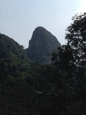
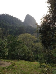
 Tabur Extreme standing majestically, seen from the farm
Malaysia, Kuala Lumpur, Taman Melawati
446m | 7.6 km | 5:26 hours
This was our second attempt to conquer Tabur Extreme via the Sunway Rydgeway route. In our earlier attempt we were not able to pass through the farm along the way as the gates were locked. As a result we had then attempted the route from Kemensah and after some searching around found our way up the the more eastern portion of the Tabur Extreme ridge without reaching the highest peak on the western end of the ridge.
Today, we started a little later in the hope that the gates might be open. We pushed off at 8.10 am from Sunway Ridgeway at the end of Jalan K5 in Taman Melawati. The initial route is exactly the same as the route to Tabur Far East. Once we reached the saddle between Tabur Far East and Tabur Extreme, we turned right towards Tabur Extreme. The path leads along the top of the saddle, up a good sized hump and then down again until it reaches the foot of the Extreme rock face (see pictures).