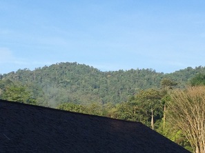
 Bukit Lagong peak seen from the east
Malaysia, Kuala Lumpur, Kepong
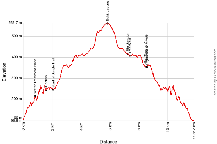
563m | 11.8 km | 6.1 hours
UPDATED: This is our sixth attempt to reach the peak of Bukit Lagong, and we finally made it!. The trail was there alright and the peak was exactly where I had estimated it to be. The trail though was badly overgrown and the journey, especially the last two kilometres was arduous as we had to hack along the way while scouting around for the trail. We have cleared as much of the path as we could to make it easy and obvious for hikers, and we have laid direction signs at tricky junctions to spur people on.
Lagong is not a very high mountain as far as Malaysian mountains go, but it is the most prominent and highest point north of KL between the coast and the Central Range. It's located beyond FRIM (Forest Research Institute of Malaysia) in Kepong and has long held my curiousity as it's the last major hill surrounding KL that I had yet to summit. And it is surprising to me that there isn't much information in the public domain on trails to the peak, not even clear information on where the peaks are located. I have tried asking at many places all around the Lagong area and even at FRIM itself and not got much accurate information. All very unusual considering that for the very active outdoor crowd in KL, Lagong would be an irresistible destination as the reserve is larger and the peak higher than any of the other popular haunts around KL. Kiara is only 256m at it's peak. Gasing is even lower at 122m, Puchong maxes out at 208m, Bukit Dinding is 307m and even Saga is only 414m at its peak. In contrast, the highest peak at Lagong is 575m, and there are many peaks in the reserve for climbers and rail runners to get excited about. So it was very exciting indeed for me to be able to finally get so close to what I believe is the highest peak at Lagong!
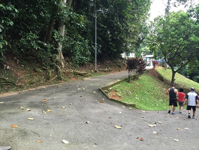
The path we took starts from within FRIM although it now appears to me that there are several other trails available, but more about that later. Park at the car park at the beginning of Jalan Symington. To get to Jalan Symington from the entrance to FRIM, take the main road from the entrance, follow left at the office buildings, and at the next main junction, turn left into Jalan Jelutong. Drive along this road until Jalan Symington, which will be on the right. After entering Symington, there are places to park your car on the left. Park anywhere here.
The path we took starts from within FRIM although it now appears to me that there are several other trails available, but more about that later. Park at the car park at the beginning of Jalan Symington. To get to Jalan Symington from the entrance to FRIM, take the main road from the entrance, follow left at the office buildings, and at the next main junction, turn left into Jalan Jelutong. Drive along this road until Jalan Symington, which will be on the right. After entering Symington, there are places to park your car on the left. Park anywhere here.
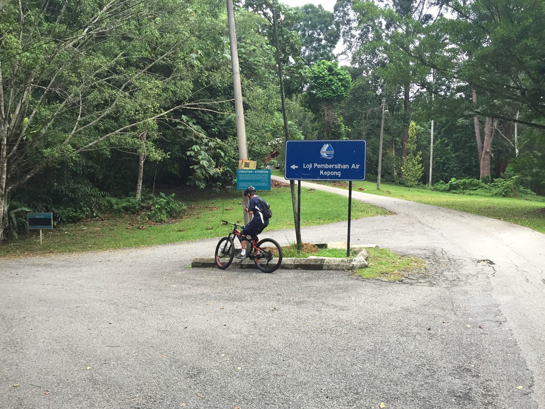
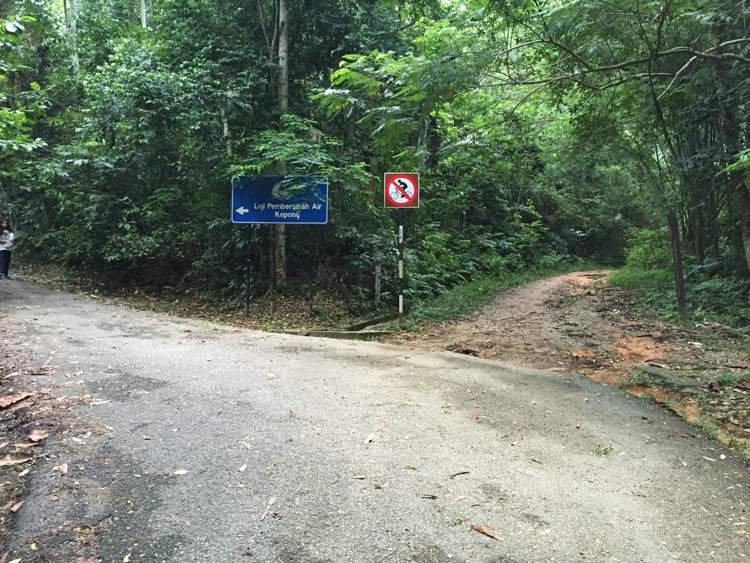
Junction at Jalan Symington that leads to the Kepong river Water treatment plant. Turn left here
|
At this junction, turn right and follow the tarred road uphill
|
At this junction, follow the tarred road to the left
|
After leaving the car, continue on-foot up-hill along Symington. There's a junction (see picture) that says "Loji Pembersihan Air Kepong" or Kepong river water treatment plant. Take a left at this junction, and then after just a couple of steps there is another junction. Turn right this time and continue heading uphill. In a short while, there is yet another junction. Turn left and follow the road up hill. This is the road that leads to the water treatment plant. The plant will be on the right after about 1 km from the car park. Up to this point, the path is tarred. Upon reaching the treatment plant, don't follow the tarred path to the right, but instead continue straight on the non-tarred trail. This is the Pipeline trail that leads to the water catchment dam for the treatment plant.
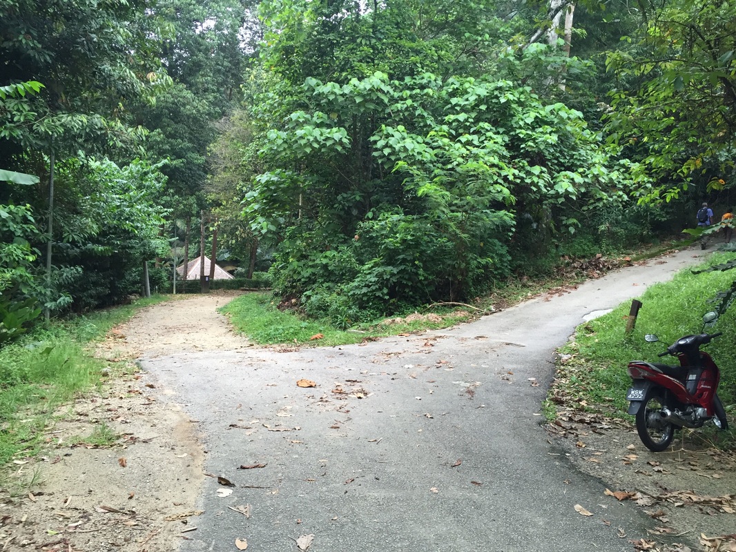
The Kepong river Water treatment plant at the end of the tarred road. Instead of turning right and around to enter the treatment plant, continue straight on to the trail
|
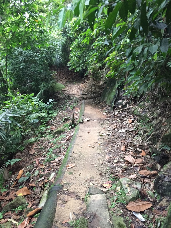
This is the start of the pipeline trail. Follow along this trail
|
Follow the Pipeline trail for another 1 km, the path is wide, mostly flat and is well maintained. It appears that water is still flowing inside the pipe and the pipe is still utilised. After 1 km (from the start of the Pipeline trail), there is a jungle trail on the right that will lead uphill from the Pipeline trail and on to the Bukit Lagong trail. The trailhead is a little difficult to spot, but the landmark is a fallen tree trunk on the Pipeline trail. The jungle path is just before the tree trunk (see pictures).
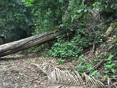
This is the point where we leave the nice pipeline trail and enter the jungle trail to the right. The landmark is the fallen tree trunk.
|
The start of te jungle trail. Notice the red ribbon around the tree on the right
|
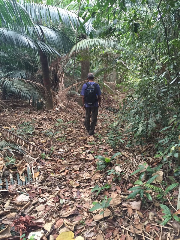
The jungle path winds its way up the hill and is fairly easy to follow as there are ribbon markers along the way to identify the path. In some places, trees have fallen, blocking and obscuring the path. One needs to carefully weave around these obstacles and join the path. This hill is a long finger that extends from Bukit Lagong all the way south to FRIM, and apparently has a name of its own - Bukit Beruang - probably because from when viewed from the south (i.e. Kepong town), only this finger is visible as a large hill, and the higher Lagong peak behind this protrusion is concealed from view.
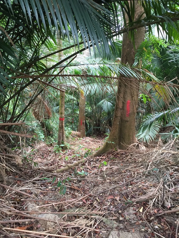
Near the top of the hill, the trail joins another wider trail which is marked with two rings of red paint on tree trunks (see pictures). The wider trail joins from the left and presumably leads downwards to the Pipeline trail at some point further on from where we came up from. But this is all very curious as we have previously travelled further along the Pipeline trail but found no obvious trails leading up the hill sides.
Anyway, the "twin rings" trail quickly takes us to the top of Bukit Beruang and then on to the reserve area for High tension pylons that bisects the hill. There are some good views of both the east and west from this point. It was a clear day and I could see Gunung Besar Hantu deep inside Negeri Sembilan very clearly. The reserve area is overgrown with shoulder height resam ferns and needs to be traversed. Follow the narrow parting among the growth and it will lead to the continuation of the twin rings trail on the other side of the reserve. There on, the trail continues with the red painted twin rings leading the way along the long ridge made by the protruding fingers. This part is relatively easy as the trail is well marked and the slopes are gentle with the path surprisingly wide. Just as well as this portion is 2 km long.
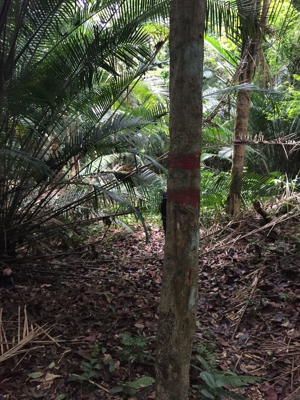
Condition of the jungle trail that leads to the top of Bukit Beruang. Note the two rings of red paint on the tree trunk - from this point onwards, the twin rings are the markers for the trail to Lagong peak
|
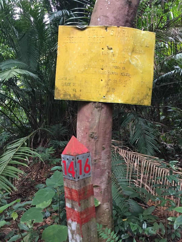
A signboard and marker post at the top of Bukit Beruang
|
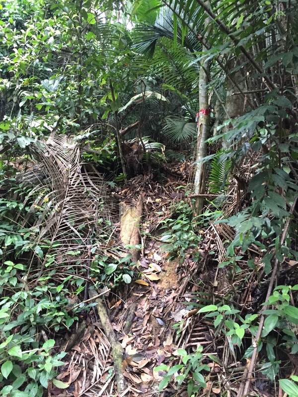
Condition of the trail after the high tension wire reserve
|
Abruptly, the "twin rings" markers seem to come to an end and the path seemingly continues to the right with helpful ribbon markers. This is not the right path! This path heads downwards and I suspect connects to the trail from the Bukit Lagong Orang Asli settlement further to the west. Certainly something to follow up in the future as this means there are multiple paths to the Lagong peak. In one of our previous attempts we had accidentally taken this part downwards and after about 10 mins realised our mistake. We doubled back to where we last encountered the double rings marker and scouted around to see if there is another path. Yes there was - the double rings markers do continue towards the left hand side, but the path was badly blocked by undergrowth and raging Bertam palms to the extent that the markers were all obscured and cannot easily be seen. It required a lot of handy work with the parang to cut our way through the thorny palm fronds and other vegetation to continue on the trail. In our last attempt, we had also set a direction sign at the junction so that hikers would not take the wrong turn. From this point, the trail had also started to become steeper as we approached the Lagong peak. We carried on like this for another 1.2 kilometres until we finally read the peak.
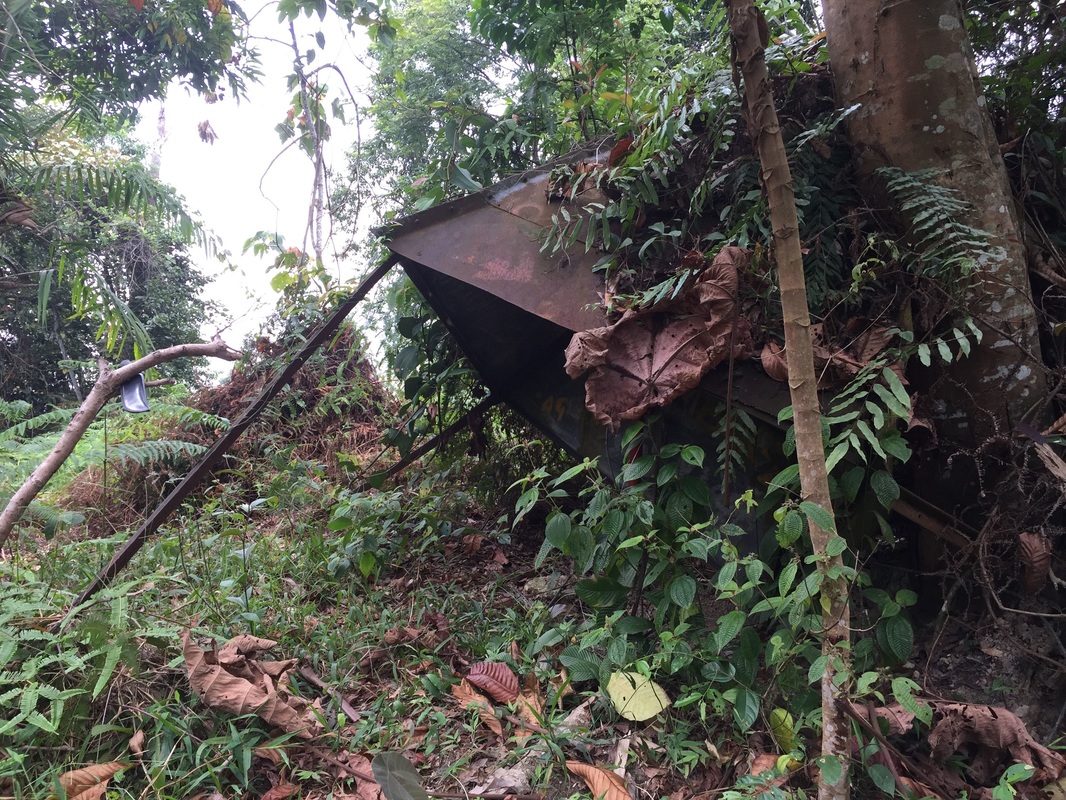
The coroding metal strcuture at the Lagong peak
|
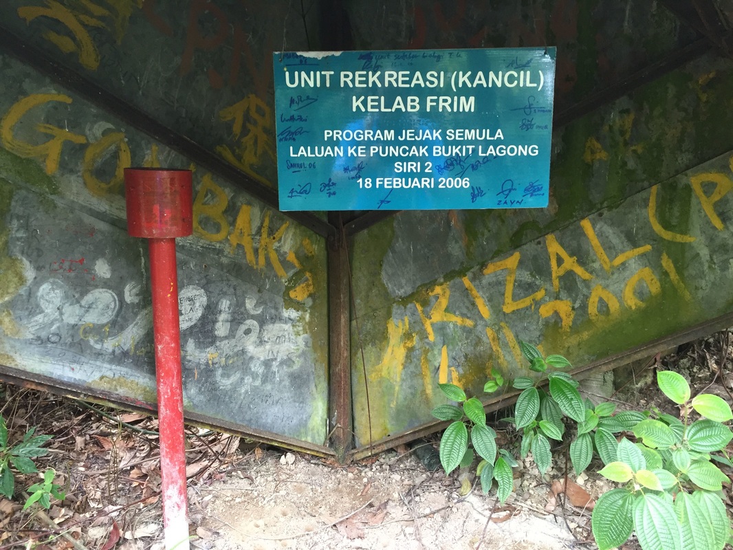
The plaque inside the metal structure at the Lagong peak
|
At the peak, there is a small clearing which now has been overtaken by Resam ferns. A little to the right is the crumbled iron trig station structure which used to mark the peak. A little further on are view points to the east and to the north. Trails can be seen heading out in various directions, but I couldn't tell whether these are simply short paths to the edge of the peak clearing or tracks that lead somewhere. At the rusting trig structure, were is a signboard stating that the path was re-cleared by the FRIM Club in 2006. Perhaps it was they who made the double-ring marks
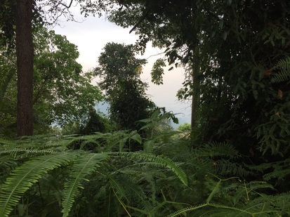
View from the peak looking east-wards. The air was heavy with haze, limiting visibility of the hills beyond
|
The continuation of the double-ring path from th epeak downwards heading to the west
|
Interestingly, the double-ring marked path continued on from the peak, this time down the hill in the west-ward direction. I suspect the path leads to another exit in the west (perhaps the quarry or the Orang Asli village in Kuang. Or it leads to one of the other lesser peaks in Lagong. The next highest peak, which is only around 20m shorter than Bukit Lagong is about 1.5 km due west of the Lagong peak. Another exploration for another day!
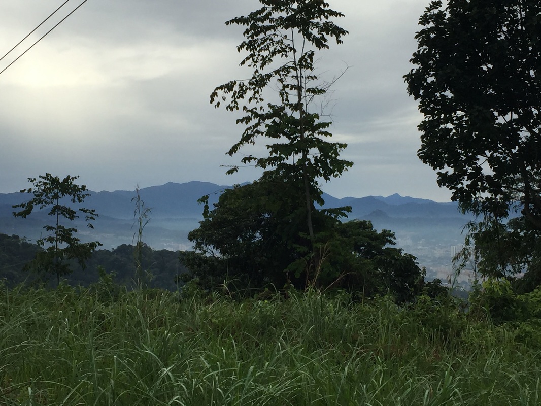
View to the east from the High tension wire reserve. Good view of the central mountain range, visible are Gunung Repin (to the left of the tree), and in the far background, Gunung Besar Hantu (the saw-tooth shaped peak to the right of the tree), the highest mountain in Negeri Sembilan
In our last attempt, we took 3.5 hour to reach the peak, and 2.5 hours to descend. The climb can probably done in a shorter time now that we have cleared the last stretch before the peak.
Trail Map and Data
| Location: | Kepong |
| Distance: | 11.8 km |
| Duration: | 6.1 hrs |
| Average Speed: | 2.2 km/h |
| Min Elevation: | 97 m |
| Max Elevation: | 563 m |
| Vertical Up: | 705 m |
| Vertical Down: | 705 m |
Related Posts
- Bukit Nolang
- Bukit Repin