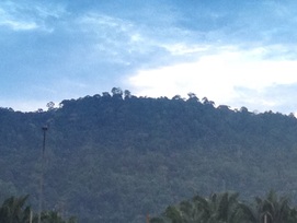
 Bukit Galla seen from the oil palm plantation near the Seremban highway rest area. This is not the peak but a lesser peak which is blocking the true peak that is at the back
Malaysia, Negeri Sembilan Labu
613m | 6 km | 3:12 hours
If you have ever travelled between Kuala Lumpur and Seremban than you would not have missed Bukit Galla. Bukit Galla is the prominent hill on the left side of the Seremban highway just as one approaches Seremban from Kuala Lumpur. It's located right behind the Seremban rest area. The hill can also be seen from the LEKAS highway or the old north-south trunk road, but on the right side if one is southbound.
It is supposedly 613m in height, and provided there is a clearing at the top, should offer good views of Sepang airport to the west, Kuala Lumpur to the north and Bukit Broga to the northeast. We weren't sure though if there were any marked tracks leading to the peak, but we took a chance and made the attempt.
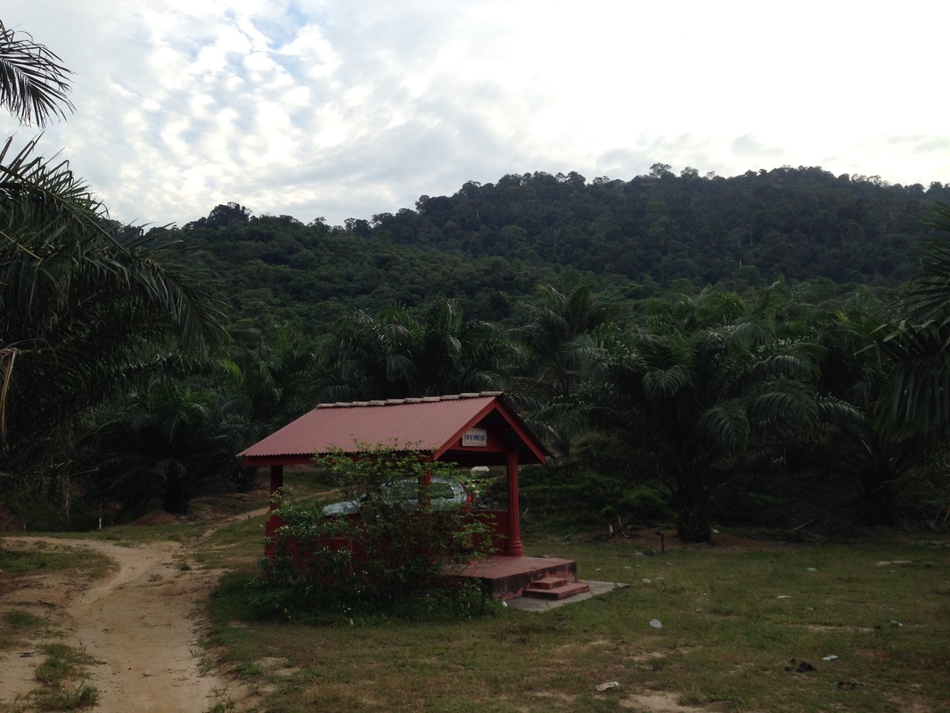
The small Hindu temple where we parked our car. The trailhead is further on behind the temple and the car, as seen from this angle. You can see Bukit Galla at the rear
The first challenge of course was to find the trailhead. We had some directions from the blogs (thank you McHiker) and with that help we managed to get to the start of the trail without too much difficulty.
If you're southbound on the Seremban highway, exit at the Seremban turn-off (the exit immediately after the Seremban rest area). After the toll plaza, turn left at the traffic lights, and then immediately turn left again into Jalan Labu at the next traffic lights. Drive for about 13km towards Labu village. There are two entrances into Labu, skip the first one. After crossing the train lines, there will be the second entrance on the right. Take that turning. Continue on past the police station (on the left), and the train station (on the right). Immediately after the train station is a small road on the left that leads into the oil palm plantation. Take that road.
If you're southbound on the Seremban highway, exit at the Seremban turn-off (the exit immediately after the Seremban rest area). After the toll plaza, turn left at the traffic lights, and then immediately turn left again into Jalan Labu at the next traffic lights. Drive for about 13km towards Labu village. There are two entrances into Labu, skip the first one. After crossing the train lines, there will be the second entrance on the right. Take that turning. Continue on past the police station (on the left), and the train station (on the right). Immediately after the train station is a small road on the left that leads into the oil palm plantation. Take that road.
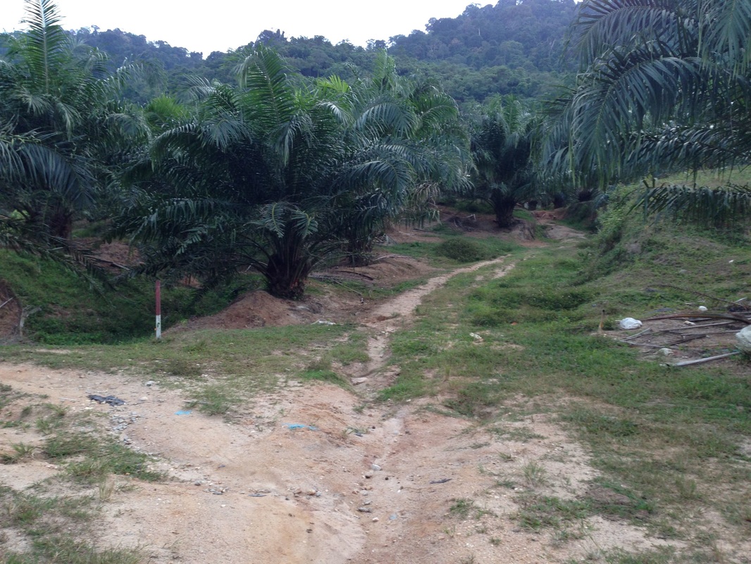
The paths as seen from the temple (temple is to the right of this picture). Take the straight path
Continue straight, the road will pass under the Seremban highway and continue on the other side. From here, there are several paths to the trail head. The one we took was the most direct one, but this is somewhat rough at one small stretch and may require a four-wheel drive. The other paths may be better but we did not try it out.
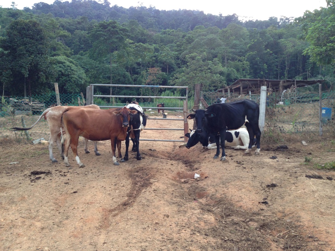
Dairy farm!! The trail head is to the left of this gate. Walk along the fence and it would take you up into the jungle
After coming out of the Seremban Highway underpass, continue straight. There will be a junction with roads heading to the left and right - go due straight. The road will pass under some high tension cables and immediately after that turn into a dirt track (but still well passable on car). Continue on for about 500-600m and you will come to a T-junction. The road to the left turns sharply, slopes steeply downwards and has some deep tyre ruts. This is the part that a car with low clearance would have some difficulty. Take the sharp left carefully. Within 80m, there will be another T-Junction. Take a right this time. 30m in front of you will a small Hindu shrine. Park your car here and continue straight on foot. In another 120m, you will come to a dairy farm. Continue to the left of the farm entrance gate. This is the start of the trail.
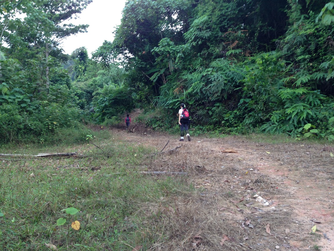
First clearing. We went straight, but we returned from a small path on the right of this picture
We were pleased to have found the trailhead and we were even more pleased to find the trail wide and well defined. It started climbing immediately and soon came to a clearing. There was a path to the right into the undergrowth but we continued on the wide trail straight ahead. We came across another, smaller path leading to the hill-side on the right, but again we continued on the main track that led straight. After about 1 km from the trail head we came to a stream that was fenced off. There were some hydraulics work of some kind, probably an intake for a reservoir or water supply system further downstream. The board made note of the water being used for the mosque and temple downriver. The path ended there, we could't see any further path beyond the stream. I tried clambering up the hill side on the right but there didn't seem to be any clear trails there. So we re-traced our path to see if any of the earlier encountered paths would yield something.
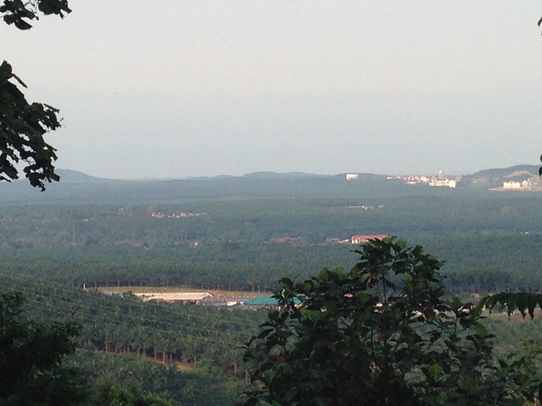
View to the west from mid way on the trail. The Seremban highway rest area (southbound) can be seen here
We took the last path that headed onto the hillside. It was a fairly clear path and went up for a short distance (100m) before it too came to dead-end with jungle on all sides. But we could see at least 3 jungle tracks heading into and up the jungle-clad hill. We took the middle one as it seemed the most promising. After a short while we couldn't find any defined path, we were just dodging past trees in the most economical fashion. Out came our tape to mark our way. We ascended steeply for another 100m (horizontal distance) until we came to some kind of an old path. We took the path towards the right and went for a further 200m when the path ended at a dried up stream bed. But clearly the stream bed itself was a path. We turned left to head up the stream-bed. We made good headway, about 200m, until the undergrowth started overwhelming us. There was however a clearer way on the jungle on the left. We took that way and were surprised (and pleased) to find an old tape marker around a tree. This was our first sign of any hiker activity
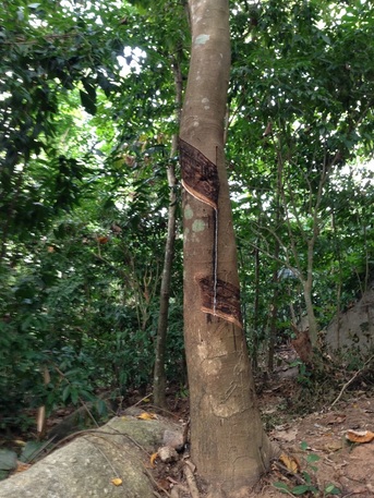 Looks like someone is still tapping the rubber. Many of the trees on the lower slopes looked like they were old rubber trees
Up to this point, we actually came across many places where there seemed to be old disused but deliberately made paths heading in all directions. In fact, the whole hill seemed to be criss-crossed with abandoned paths. Very odd.
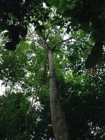
But after leaving the stream bed, it seemed like we were now really on a jungle track. With some difficultly we tried to find a track through the trees. We continued for some while and was encouraged to see 2 more old tape markers tied around trees. But they were few and really far in between. We had ascended quite a bit but we could still see the stream bed below on the right. Soon though, our path seemed to go down and cross the stream bed and then continue up the hill on the other side. By now, the flora was very different from earlier. The trees were sparser but much larger. And there was less undergrowth as well. In contrast, the jungle earlier was thick with undergrowth and had many similar looking trees (in fact they looked like wild rubber trees).
We continued further up hill but soon lostt all signs of anyone having gone past this way before. We had been walking for 2 hours and only reached 280m in height. We still had 350m to climb and the going was very slow as we were still trying to find where the "correct" track was, if there ever was a track there. Upon hearing distant thunder, we decided to quit this time and turned around.
We headed back to the dry stream bed and descended down that path until we came to the point that we joined the stream bed. Since the stream bed path still continued downhill, we decided to go further down to see where it heads to. Again we saw many disused paths on the left and right but we headed straight down.
 Same rubber tree
Further down, the stream bed path ended abruptly with many smaller paths leading in 3 directions. We tried the one on the left but it led in the wrong direction, away from our trailhead. Took the one to the bottom right which went well and fairly level for a while until we encountered fallen tries which made the path impassable (only one of many obstacles that we came across that day). Not having much choice, we clambered up the very steep hill side on our right until we came to another track higher up. That track led us back to the main track, joining at the first clearance.
Somewhat disappointing that we were so far short of the peak, but it was a good effort, and at least we now know which roads don't lead anywhere. The path we ended up taking still holds promise and we should return someday to progress it further. We were somewhat led astray by the changing nature of the paths and terrain. Initially, the path was wide, straight and clear, and that set our expectation on how the path should look like. But that path only led to the fenced up water intake. Obviously this was a commercially maintained path but unfortunately doesn't lead us to the peak. The next set of paths were disused tracks which criss-crossed the lower parts of the hill. I am guessing that in earlier days the lower slopes of the hill were rubber plantations and the old tracks were the rubber-tapper paths. I have seen the paths in old rubber estates before (e.g. Kiara hill), and it's just a maze of walkways. Once we adjusted to the many-paths terrain, we were again left with the wrong expectations when we crossed into primary forest. Here there were no plantation tracks, only faint traces of past hiker trails. I spent quite some time looking for the wider tracks when I should have just concentrated on keeping to the faint jungle path.
Somewhat disappointing that we were so far short of the peak, but it was a good effort, and at least we now know which roads don't lead anywhere. The path we ended up taking still holds promise and we should return someday to progress it further. We were somewhat led astray by the changing nature of the paths and terrain. Initially, the path was wide, straight and clear, and that set our expectation on how the path should look like. But that path only led to the fenced up water intake. Obviously this was a commercially maintained path but unfortunately doesn't lead us to the peak. The next set of paths were disused tracks which criss-crossed the lower parts of the hill. I am guessing that in earlier days the lower slopes of the hill were rubber plantations and the old tracks were the rubber-tapper paths. I have seen the paths in old rubber estates before (e.g. Kiara hill), and it's just a maze of walkways. Once we adjusted to the many-paths terrain, we were again left with the wrong expectations when we crossed into primary forest. Here there were no plantation tracks, only faint traces of past hiker trails. I spent quite some time looking for the wider tracks when I should have just concentrated on keeping to the faint jungle path.
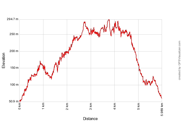
Trail Map and Data
View map fullscreen | View on Everytrail | Download GPX file
| Location: | Labu |
| Distance: | 6 km |
| Duration: | 3:12 hrs |
| Average Speed: | 2.4 km/h |
| Min Elevation: | 51 m |
| Max Elevation: | 295 m |
| Vertical Up: | 486 m |
| Vertical Down: | 479 m |
Related Posts
- Bukit Broga

