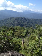
 View of the east from the peak of Bukit Kutu. The chimney of the 1st bungalow can be seen below. In the background is Gunung Rajah
Malaysia, Selangor, Kuala Kubu Bahru
1058m | 6.8 km | 3:44 hours
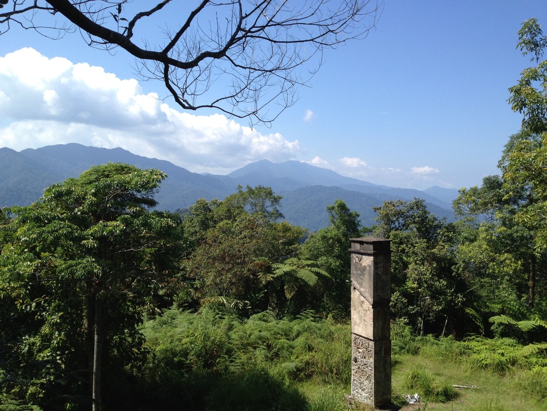
Bukit Kutu, formerly known as Treacher's Hill is an abandoned colonial hill station just upstream of the original Kuala Kubu town (now known as Kampung Ampang Pecah). It has an interesting history, the hill station was founded in 1893 by William Hood Treacher, resident of Selangor, whilst on a working tour of Kuala Kubu and surrounding districts. There were supposedly two bungalows at the top which functioned as a health retreat for the British administrators. A bridle path (horse or donkey trail) connected it to the old Kuala Kubu town. The hill station fell into disuse after the more prominent Frasers Hill was re-developed into a hill station and opened to the public in 1922. During the Japanese invasion in 1942, the British army supposedly destroyed the bungalows as they retreated ahead of the advancing Japanese forces. All that remains today are the chimney and veranda steps of one of the bungalows. There is another sturdier structure on the Kuala Kubu side of the peak. Most refer to this as the "sanatorium" and some call it the 2nd bungalow. I think the whole hill station is referred to as the "sanatorium" by the British as similar references can be found for the Penang and Maxwell hill stations. I do not think there was actually a building or hospital of some sort called "sanatorium" at Bukit Kutu. I also am somewhat sceptical of the notion that this building was the 2nd Treacher's Hill bungalow. The first bungalow was a wooden building with brick steps, fireplace and chimney. Several photographs of the first bungalow survive. As mentioned, very little of the 1st bungalow remains but the identity of the bungalow can be of no doubt due to the distinct fireplace, chimney and the mountain views that form the backdrop to the bungalow in the old pictures. In contrast, much more of the 2nd structure remains, including stone walls, arched doorways and steps. It's an altogether bigger structure and much more stout and sturdy in appearance. The walls are thick, far thicker than what we see in brick bungalows from that period even in towns. There doesn't seem to be any sound merit for its strong walls especially considering the additional effort of carrying building material and workers 1000m up into the hills. I am of the opinion that this building is a fort or defensive structure of some kind, either built during World War 2 or a structure from an even older period, perhaps even before W. H. Treacher's visit to the hill in 1893.
1058m | 6.8 km | 3:44 hours
Bukit Kutu, formerly known as Treacher's Hill is an abandoned colonial hill station just upstream of the original Kuala Kubu town (now known as Kampung Ampang Pecah). It has an interesting history, the hill station was founded in 1893 by William Hood Treacher, resident of Selangor, whilst on a working tour of Kuala Kubu and surrounding districts. There were supposedly two bungalows at the top which functioned as a health retreat for the British administrators. A bridle path (horse or donkey trail) connected it to the old Kuala Kubu town. The hill station fell into disuse after the more prominent Frasers Hill was re-developed into a hill station and opened to the public in 1922. During the Japanese invasion in 1942, the British army supposedly destroyed the bungalows as they retreated ahead of the advancing Japanese forces. All that remains today are the chimney and veranda steps of one of the bungalows. There is another sturdier structure on the Kuala Kubu side of the peak. Most refer to this as the "sanatorium" and some call it the 2nd bungalow. I think the whole hill station is referred to as the "sanatorium" by the British as similar references can be found for the Penang and Maxwell hill stations. I do not think there was actually a building or hospital of some sort called "sanatorium" at Bukit Kutu. I also am somewhat sceptical of the notion that this building was the 2nd Treacher's Hill bungalow. The first bungalow was a wooden building with brick steps, fireplace and chimney. Several photographs of the first bungalow survive. As mentioned, very little of the 1st bungalow remains but the identity of the bungalow can be of no doubt due to the distinct fireplace, chimney and the mountain views that form the backdrop to the bungalow in the old pictures. In contrast, much more of the 2nd structure remains, including stone walls, arched doorways and steps. It's an altogether bigger structure and much more stout and sturdy in appearance. The walls are thick, far thicker than what we see in brick bungalows from that period even in towns. There doesn't seem to be any sound merit for its strong walls especially considering the additional effort of carrying building material and workers 1000m up into the hills. I am of the opinion that this building is a fort or defensive structure of some kind, either built during World War 2 or a structure from an even older period, perhaps even before W. H. Treacher's visit to the hill in 1893.
First bridge across the Pertak river, just after leaving the car behind. The bank on the right hand side of the bridge seems to be a popular picnic spot
|
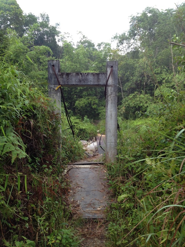
Second bridge, this one broken. Probably smashed by fallen logs floating down the swollen stream after a downpour
|
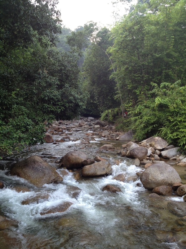
The stream, taken from the middle of the broken bridge
|
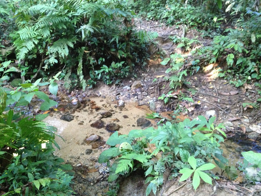
The original path from Kuala Kubu has long been been reclaimed by the jungle. The present path is a new one starting from Kampung Pertak, an Orang Asli settlement at the bank of the Pertak river. The path approaches the hill from the opposide side, i.e. from the north and east. We drove on the KKB-Gap road and soon after crossing the long bridge over the Sungai Selangor reservoir there is a small road leading to the right. The road is marked with signs for Kampung Pertak. Once past the Orang Asli houses, the small road eventually becomes a gravel track and ends at the bank of Sungai Pertak. From here, we went on foot.
Crossing the third river which has no bridge. Water was up to knee level
|
The next stream was a tiny one, easily crossed without getting shoes wet
|
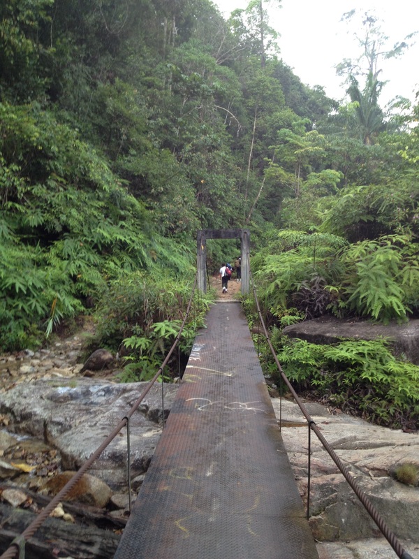
There is a suspension bridge crossing the river and a track from there on. After 0.5km, we came across another stream and another suspension bridge, this one all twisted and broken with broken tree trunks and logs strewn all over the bridge. It's still enough to tentatively cross the stream without getting ones feet wet. But it is a little frightening to think what could have caused the bridge to be torn apart like this (the stream when it swells with rain water!!).
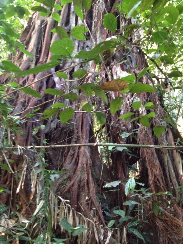
Large tree covered with roots of some vine, spotted along the way
|
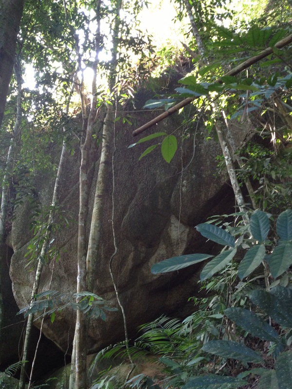
Giant bolder along the way.
|
The route goes up and beside the giant boulders
|
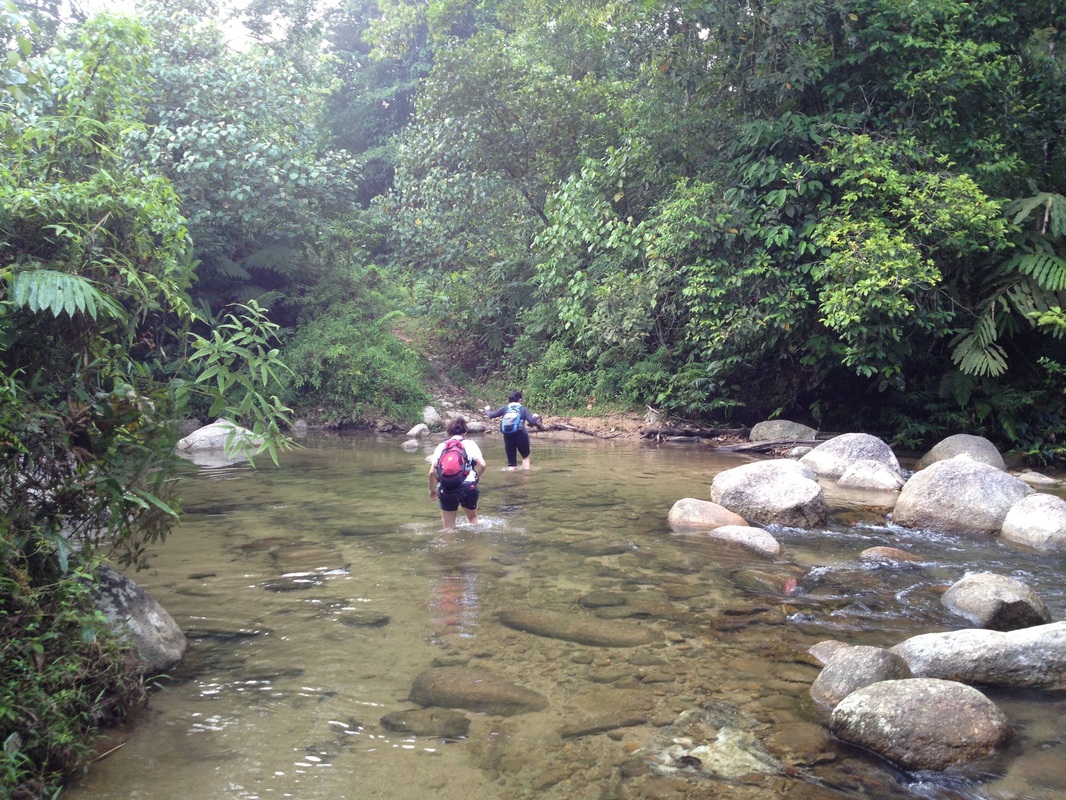
After another 0.5km, we came across yet another stream, but this one without a bridge. We waded across the stream (about knee deep, but presumably all depends on the rain situation!). 0.3km further, we needed to turn right into a small track into the grass and bushes. The junction is marked with some paper markers, but it's hardly an obvious sign (or path). The original track however seems to continue on (don't know where but apparently to a series of waterfalls). Our smaller track continued for 0.4km before we came across another stream, much smaller than the previous one. We crossed and continued on the track. Thus far, the track had been pretty flat. Soon though the path starts ascending, and quite steeply too.
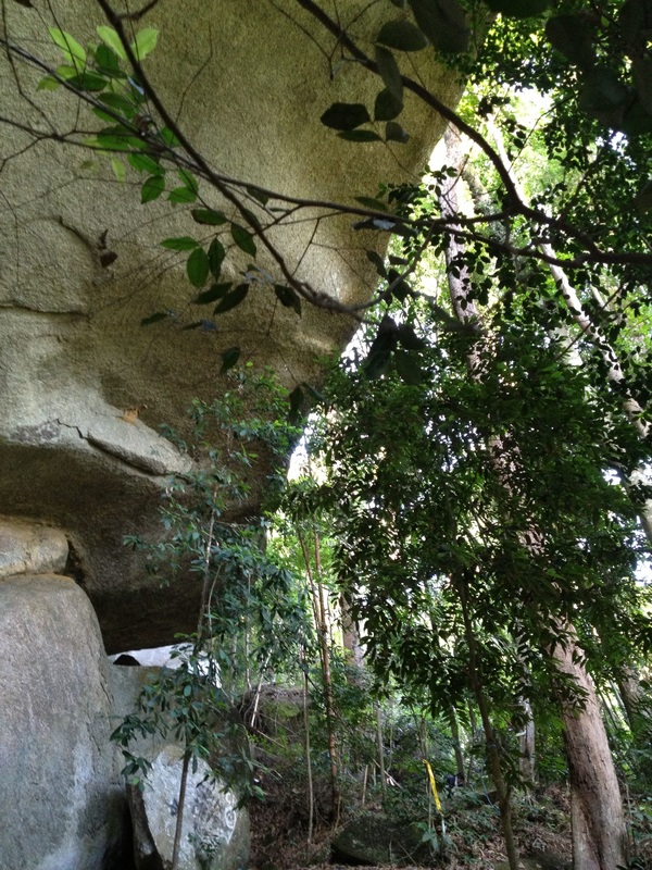
Remnants of the first hill top bungalow. Gunung Rajah can be seen in the background
At about the half-way point we came across a giant boulder perhaps 100 feet or more tall. We ascended beside it until we reached almost the top of the boulder. It seemed to be a popular camping or resting site.
Before long we reached a flat area near the top of the hill, the site of the first bungalow. It's now a camping site, but the chimney remnants are still there. Carrying on a little further from there leads to the peak which is a large rock that must be climbed using ladders that someone has installed. The view from the top of the rock is simply spectacular. To the east, forming the backdrop to the chimney of the 1st bungalow is majestic Gunung Rajah, a 1683m mountain. To the north, the chain of mountains forming the Titiwangsa Range is clearly visible, including Ulu Semangkok, Fraser's Hill, Pine Tree Hill, Twin Peak and Semangkok far in the north.
Before long we reached a flat area near the top of the hill, the site of the first bungalow. It's now a camping site, but the chimney remnants are still there. Carrying on a little further from there leads to the peak which is a large rock that must be climbed using ladders that someone has installed. The view from the top of the rock is simply spectacular. To the east, forming the backdrop to the chimney of the 1st bungalow is majestic Gunung Rajah, a 1683m mountain. To the north, the chain of mountains forming the Titiwangsa Range is clearly visible, including Ulu Semangkok, Fraser's Hill, Pine Tree Hill, Twin Peak and Semangkok far in the north.
View of the north east from the peak of Bukit Kutu
It's a strenuous hike, not all an easy walk as suggested by its "Bukit" name. It took us almost 4 hours to reach the top, and about 2.5 hours to descend. Be prepared to get your legs wet, and be careful when crossing the rivers during the rainy season.
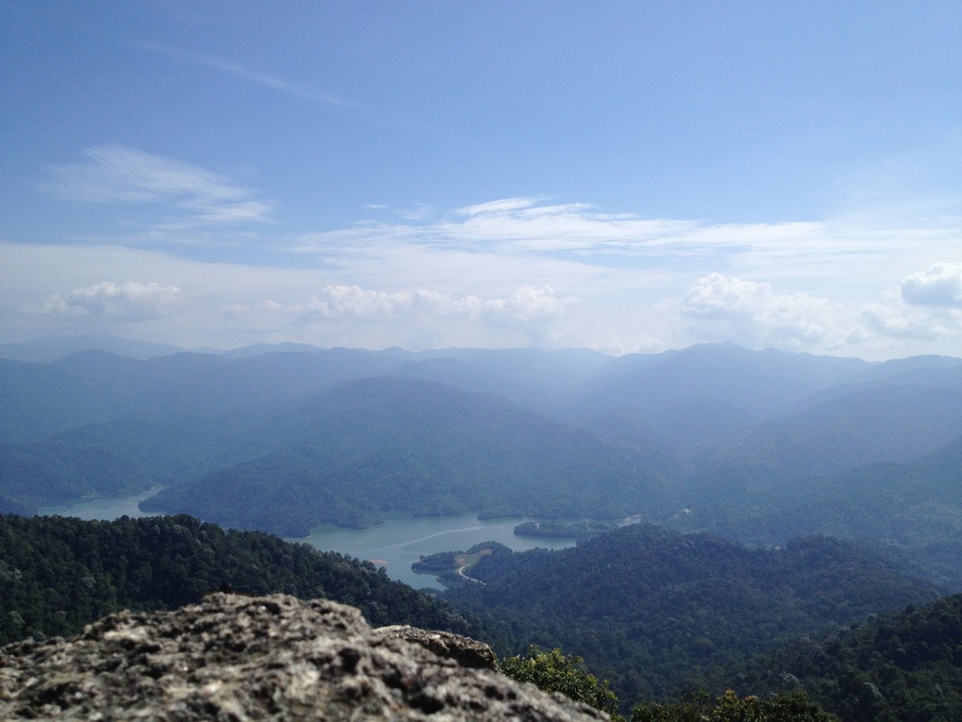
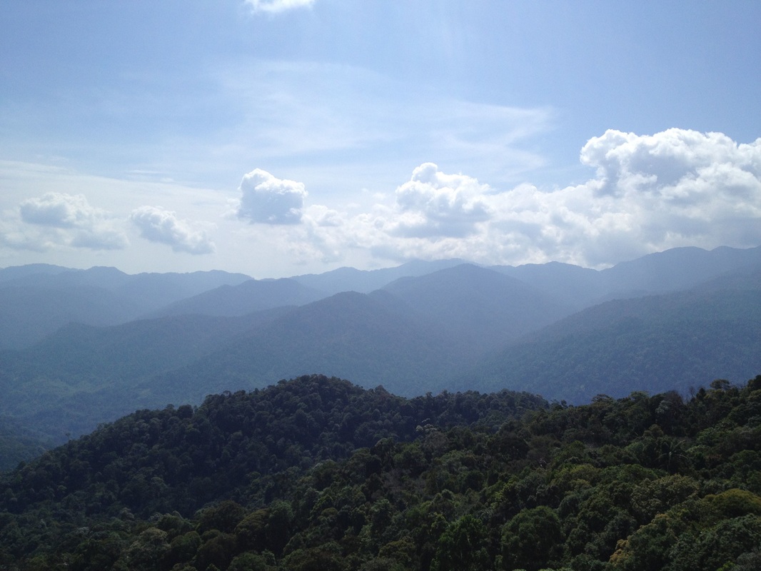
View of the north from the peak of Bukit Kutu. The prominent peaks of the Titiwangsa range are clearly visible. From right to left: Gunung Ulu Semangkok (highest peak on the right one-third of the picture), Gunung Gap (the small peak just to the right of a deep break in the mountain range. The break is where Gap is), Bukit Peninjau (the highest peak in Frasers Hill, just to the left of the Gap saddle), Pine Tree & Twin Peak (a double peak about one-third from the left of the picture - it's the highest mountain there) and Gunung Semangkok (the giant mountain on the far left, just about visible below the cloud). At the bottom of the picture is the Selangor river reservoir, the L-shaped road at the bottom bank of the lake is the KKB-Gap trunk road
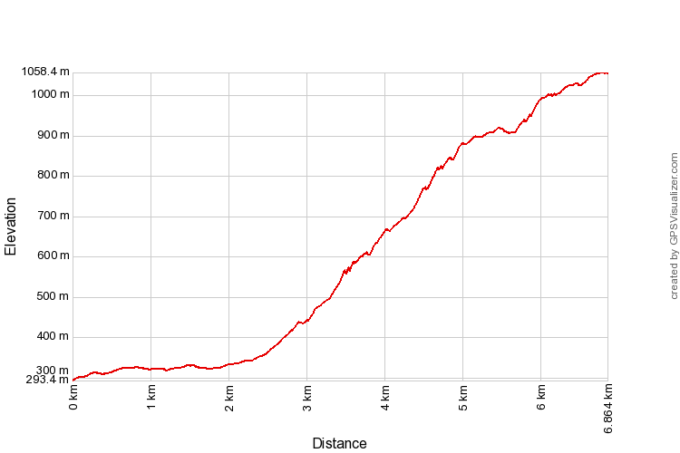
Trail Map and Data
View map fullscreen | View on Everytrail | Download GPX file
| Location: | Kuala Kubu Bahru |
| Distance: | 6.8 km (one way) |
| Duration: | 3:44 hrs |
| Average Speed: | 1.8 km/h |
| Min Elevation: | 293 m |
| Max Elevation: | 1058 m |
| Vertical Up: | 803 m |
| Vertical Down: | 41 m |
Related Posts
- Gunung Ulu Semangkok
- Gunung Ulu Gap
- Pine Tree

