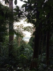
 View of Kuala Lumpur city through the foliage along the Bukit Saga trail
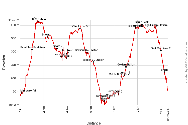
419m | 12.6 km | 5:30 hours
It's real name is probably Bukit Sungai Putih, after the stream that makes the Sungai Putih waterfall. But it certainly has no shortage of popular names though: Saga Hill, Bukit Ahpek, Cheras Hill. Apparently it's called Ahpek hill because of the large number of elderly climbers who crowd the hills during the early mornings (Ahpek means Uncle in Chinese). The name Bukit Saga probably originates from the neighbouring Taman Saga housing estate where one of the trails start from. Interestingly, the peak near the Taman Saga entrance is often called Bukit Saga, but the peak further south is usually called Bukit Ahpek. But as I said earlier, I think these are just popular names. The real name before the housing estates were opened and before the uncles popularised the trails was likely Bukit Sungai Putih. Indeed, the forest reserve that covers the hill is still called Hutan Bukit Sungai Putih.
There are many entrances to the hill and many paths to enjoy. Starting from the Taman Saga trailhead, it is possible to climb to the peak and return in just 1:30 hours, a height difference of 300m, making the hill a great and easily accessible place to work ones legs. For this trip however, we wanted to make the longest round trip possible, essentially doing a 12.6 km giant loop transversing the hill twice but never taking the same path twice (except at the end).
Trail Map and Data
| Location: | Cheras |
| Distance: | 12.6 km |
| Duration: | 5:30 hrs |
| Average Speed: | 2.1 km/h |
| Min Elevation: | 101 m |
| Max Elevation: | 419 m |
| Vertical Up: | 840 m |
| Vertical Down: | 826 m |


