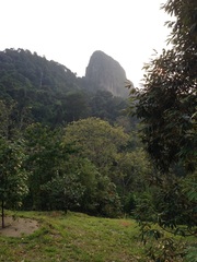
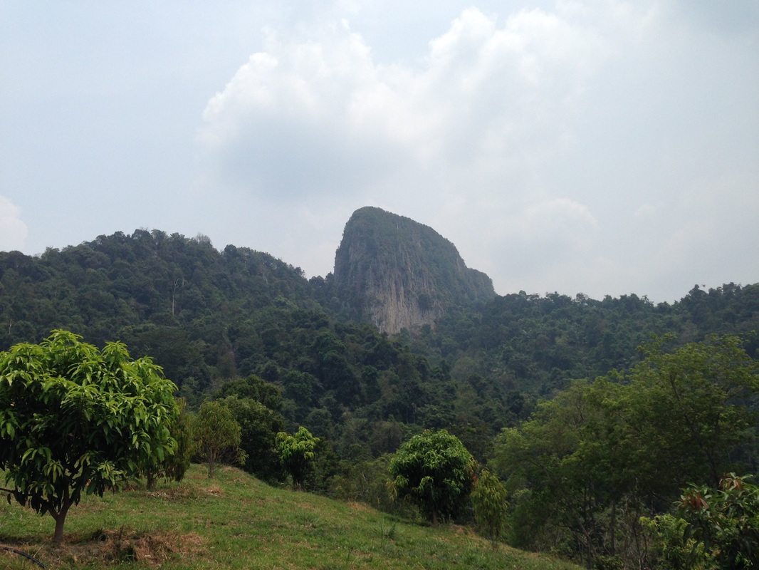
 Tabur Extreme standing majestically, seen from the farm
Malaysia, Kuala Lumpur, Taman Melawati
446m | 7.6 km | 5:26 hours
This was our second attempt to conquer Tabur Extreme via the Sunway Rydgeway route. In our earlier attempt we were not able to pass through the farm along the way as the gates were locked. As a result we had then attempted the route from Kemensah and after some searching around found our way up the the more eastern portion of the Tabur Extreme ridge without reaching the highest peak on the western end of the ridge.
Today, we started a little later in the hope that the gates might be open. We pushed off at 8.10 am from Sunway Ridgeway at the end of Jalan K5 in Taman Melawati. The initial route is exactly the same as the route to Tabur Far East. Once we reached the saddle between Tabur Far East and Tabur Extreme, we turned right towards Tabur Extreme. The path leads along the top of the saddle, up a good sized hump and then down again until it reaches the foot of the Extreme rock face (see pictures).
The peaks of Tabur Extreme portion of Klang Gates Quartz Ridge. We reached the second peak from the left
 View of the Klang Gates lake from the hump on the saddle
From there, the path continues on the north side of the ridge through forest for a further 1 km. Although the trail is clear and well marked, the going is difficult and slow as the path is very narrow on the steep side of the ridge. Quite some effort is needed to avoid losing traction and slipping down the hillside. The path then turns right and starts its steep ascent up the side of the ridge. The hardest part is a vertical climb of some 15m on a soil wall. There is a rope there thankfully to help us climb. The path from there continues upwards, sometimes reaching 70-80 degrees in incline. There aren't any steps cut into the path and it's very easy to just slide off the slope to the forest below. Much caution is required to navigate this path safely.
Eventually we reach the top of the rocky ridge. We can turn left and quickly reach the end of that portion of the ridge. Some distance away is the continuation of the ridge to the east. The path seems to lead downwards to the forest and presumably continue up the distant ridge. I am beginning to suspect that the ridge on the other side is the one that we climbed during our previous attempt from the Kemensah/Zoo side. So it is possible then to reach where we were from the Kemensah side if we use the path that connects the two ridge portions. It would involve a massive descent and ascent though to cross the deep and wide chasm between the two portions.
Eventually we reach the top of the rocky ridge. We can turn left and quickly reach the end of that portion of the ridge. Some distance away is the continuation of the ridge to the east. The path seems to lead downwards to the forest and presumably continue up the distant ridge. I am beginning to suspect that the ridge on the other side is the one that we climbed during our previous attempt from the Kemensah/Zoo side. So it is possible then to reach where we were from the Kemensah side if we use the path that connects the two ridge portions. It would involve a massive descent and ascent though to cross the deep and wide chasm between the two portions.
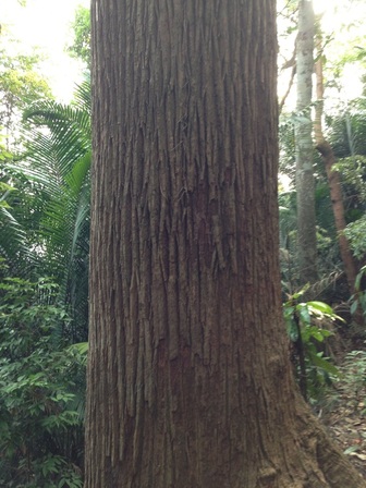
One of many giant trees spotted along the path
|
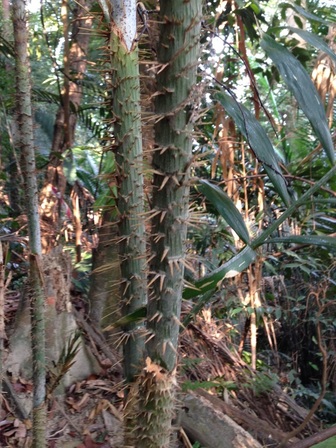
A very thorny plant blocking the path
|
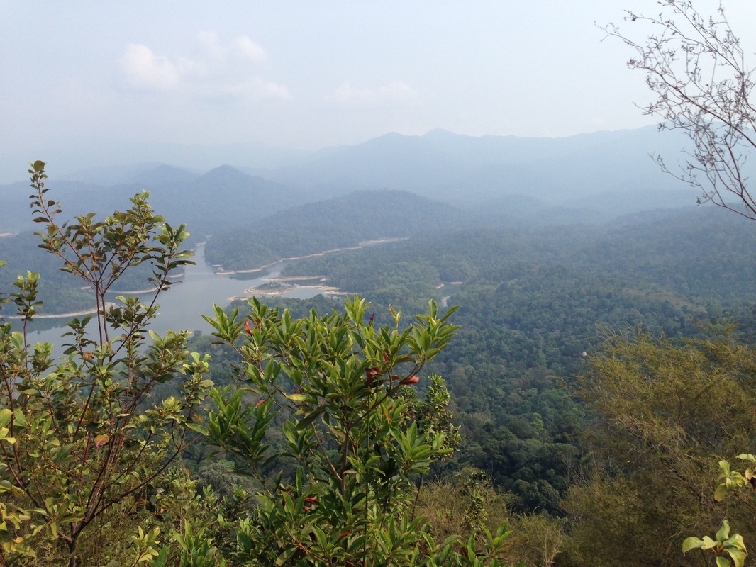
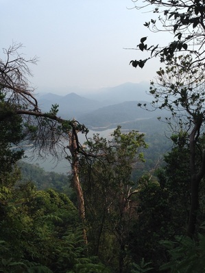
View of the lake from the top
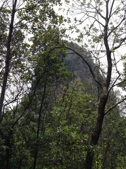 Tabur Extreme seen from the hump on the saddle
In the other direction, the path goes on top of the ridge until we reach a crevice about 3 metres wide and 8 metres deep. It is possible to climb down the crevice and cross across to the other side, but we probably need some rope for additional security. On the other side of the crevice is a climb of about 30m to the next peak. From the map, the peak across the crevice appears to be the last one and the highest one in Tabur Extreme. We were close, but we were also tired and weren't sure if we could safely make the descent into the crevice without additional ropes. So we decided to save our energy for the return journey and turned around.
The path was clearly marked all the way and fairly free from undergrowth. Better than I had dared hope.
The path was clearly marked all the way and fairly free from undergrowth. Better than I had dared hope.
Another picture of the Tabur Extreme taken from the farm
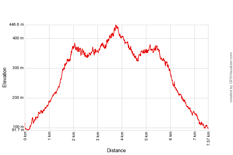
Trail Map and Data
| Location: | Taman Melawati |
| Distance: | 7.6 km |
| Duration: | 5:26 hrs |
| Average Speed: | 1.7 km/h |
| Min Elevation: | 92 m |
| Max Elevation: | 446 m |
| Vertical Up: | 599 m |
| Vertical Down: | 598 m |