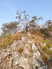
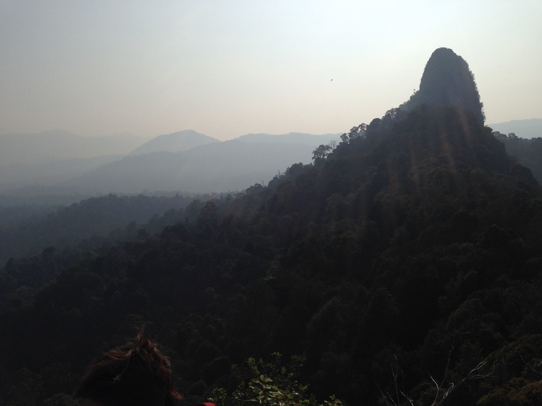
 The view looking forward on our trail heading to peak #2, the highest peak in Tabur Far East
Malaysia, Kuala Lumpur, Taman Melawati
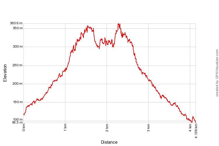
363m | 4.1 km | 3:21 hours
Tabur Far East is part of the famous Klang Gates Quartz Ridge in Hulu Kelang. Going from west to east, it is the set of peaks after Tabur East. There is another set of peaks even further east, and that is the so-called Tabur Extreme. I was initially under the impression that Tabur Far East and Tabur Extreme were one and the same, and only when researching the directions for this trip that I learnt that they were in fact distinct sets of peaks on the ridge.
When climbing Tabur East from the Klang Gates Dam, the trek goes up the Tabur East ridge, goes up and down 4 peaks before it ends at a sheer cliff that drops some 50m down to the forest floor. Beyond the void is Tabur Far East. It is not possible to access Tabur Far East from the Tabur East trek, or even from the forest floor below as it starts as a vertical wall. It has to be accessed by climbing the ridge from the other side.
Which is what we did.
Tabur Far East is not as long nor as high as Tabur East (or Tabur West, for that matter), the trails ends after about 2 km and the highest point is only about 363m. But it does have challenging sections, and in my opinion, some dangerous parts.
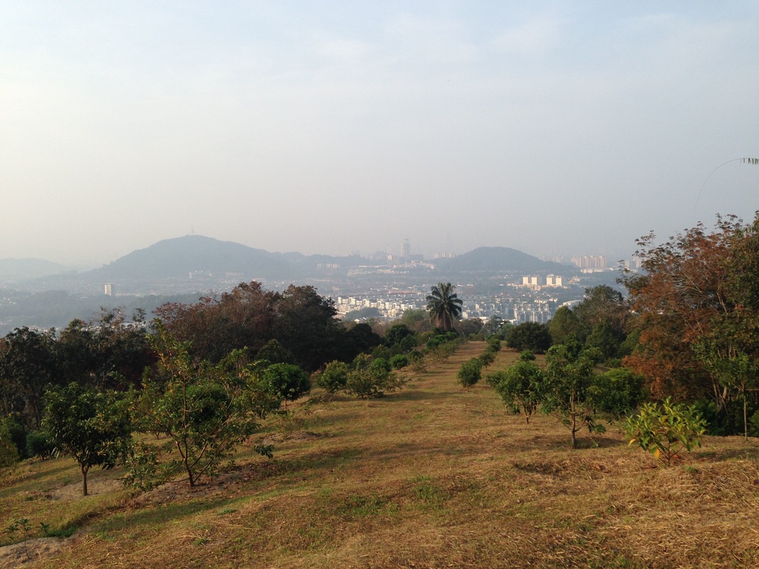
KL city when looked back from the grassy fairway
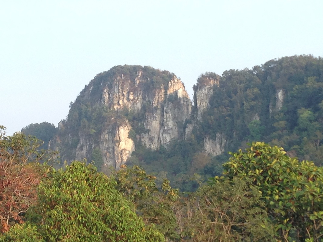
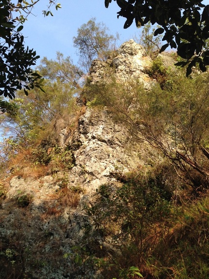 Our first major obstacle: the great rock wall that must be climbed to reach the highest peak
Go to Jalan K5 in Taman Melawati in Hulu Kelang. Sunway Ridgeway is the last completed development on the road. Park around there and walk the rest of the way. At the end of the tarred road, turn right onto some construction path and then immediately turn left to go up the hill. In a short while you will reach another development with big concrete slope abutments. Go into the development, turn left at the first junction inside the development and walk upwards towards the hills. At the end of that development will be two paths right next to each other and heading in the same direction. The left path is the original one while the right path is a new construction path that leads to yet another development. Take the left one. The path will head beside a rubber estate. Soon you will see a fence on the right with wine bottles neatly tied to the fence. On the other side of the fence is a house with lots of barking dogs. I have seen other path descriptions where the hiker is walking inside the house compound, but I suspect that the path that leads that way is no longer accessible due to the earlier construction. In any case, after a few mins of walking, the fence will give way to a gate which will lead into the compound. Go through the gate and continue walking and you will reach a farm so sparse on trees that it looks like a golf course. Carry on through the farm upwards in the direction of the hill. Walk by another house and keep going upwards through the farm. The views from here are spectacular, both looking towards the hills with Tabur Extreme on the right and Tabur East/Far East on the left, as well as looking back towards the city (check out some of the photos in this trip).
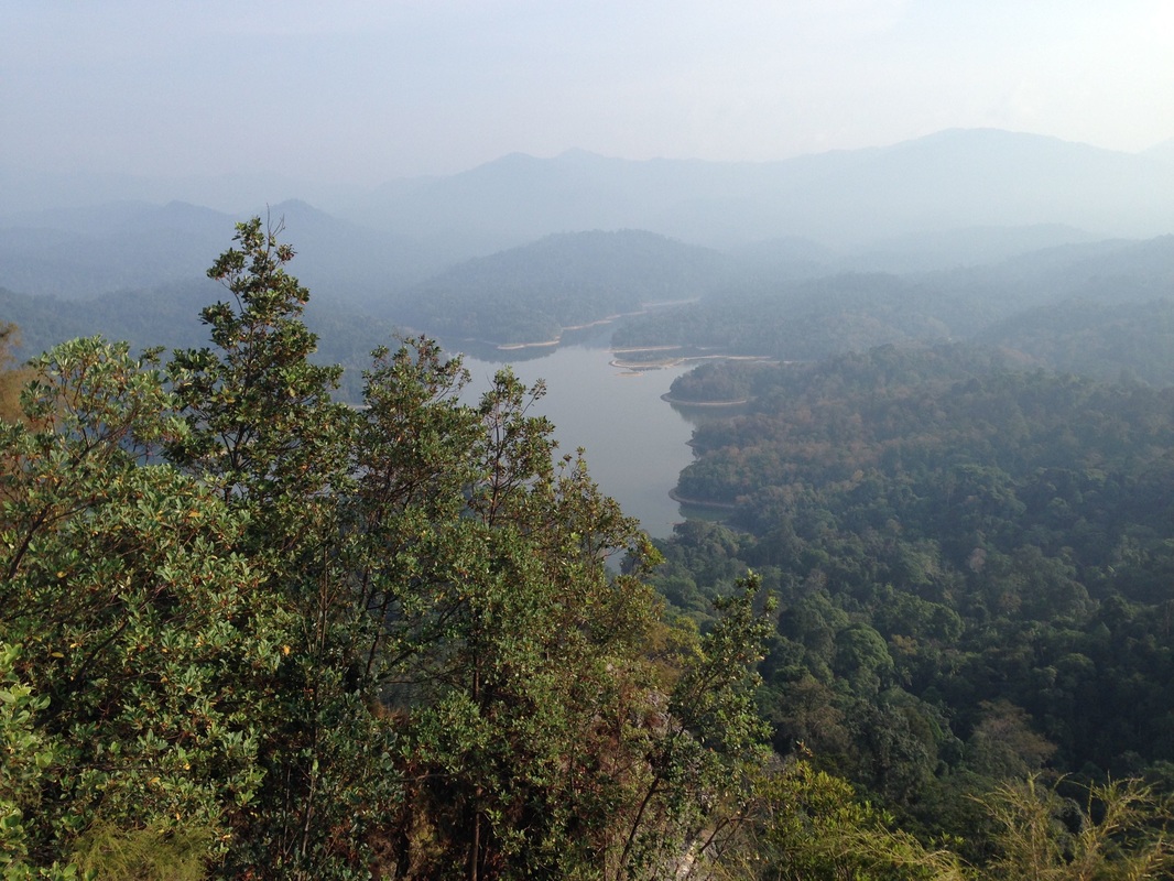
Klang Gates Reservoir seen from the top of Tabur Far East. It was a hazy day...
A dreamy mythical photo of Misty Mountains from Middle Earth. Nah just kidding. It's only Gunung Chenuang in the background (middle) and Tabur Extreme in the foreground.
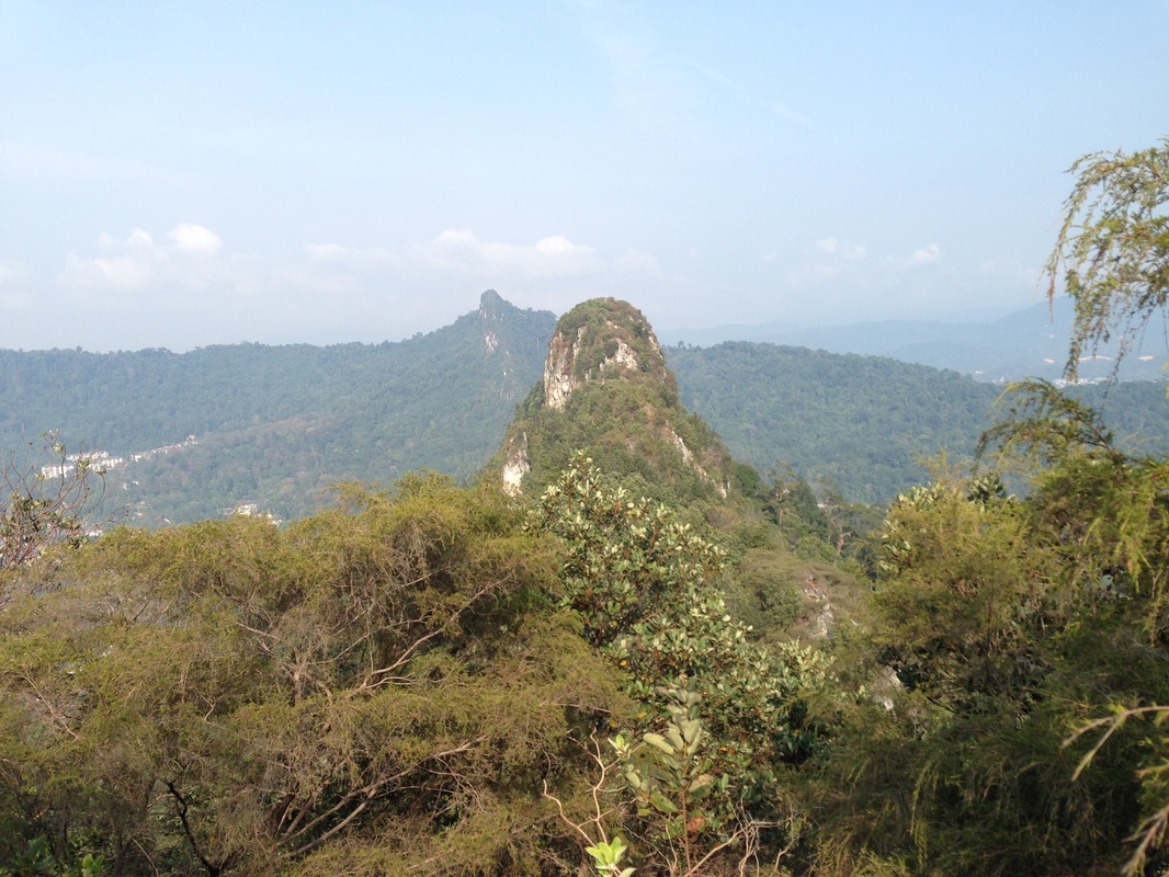
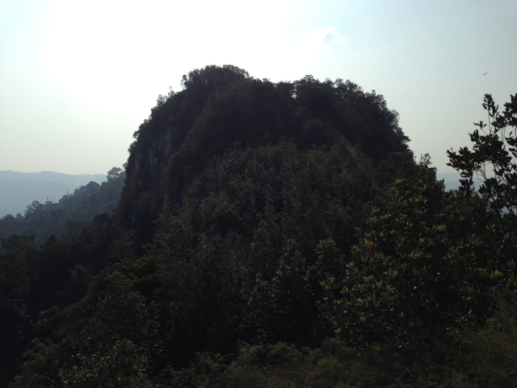
Looking to the west from near the start of the trail - Tabur East and Tabur Far East. The high point in the middle is the highest peak of Tabur East. The deep "cut" just to the right of the high peak is the boundary between Tabur East and Tabur Far East
At the end of the farm, where the grass ends and the forests begin, there will be a break in the jungle with a track. Take the track. Into the forest. It's fairly steep and gets steeper as one progresses up. After 0.3km and a bout of super steep climbing we reach the saddle on the Klang Gates Quartz Ridge between Tabur Far East and Tabur Extreme. The saddle itself is at 289m altitude and forms the break between Tabur Fast East and Tabur Extreme. The path to the right leads to Tabur Extreme. We turned left to climb Tabur Far East.
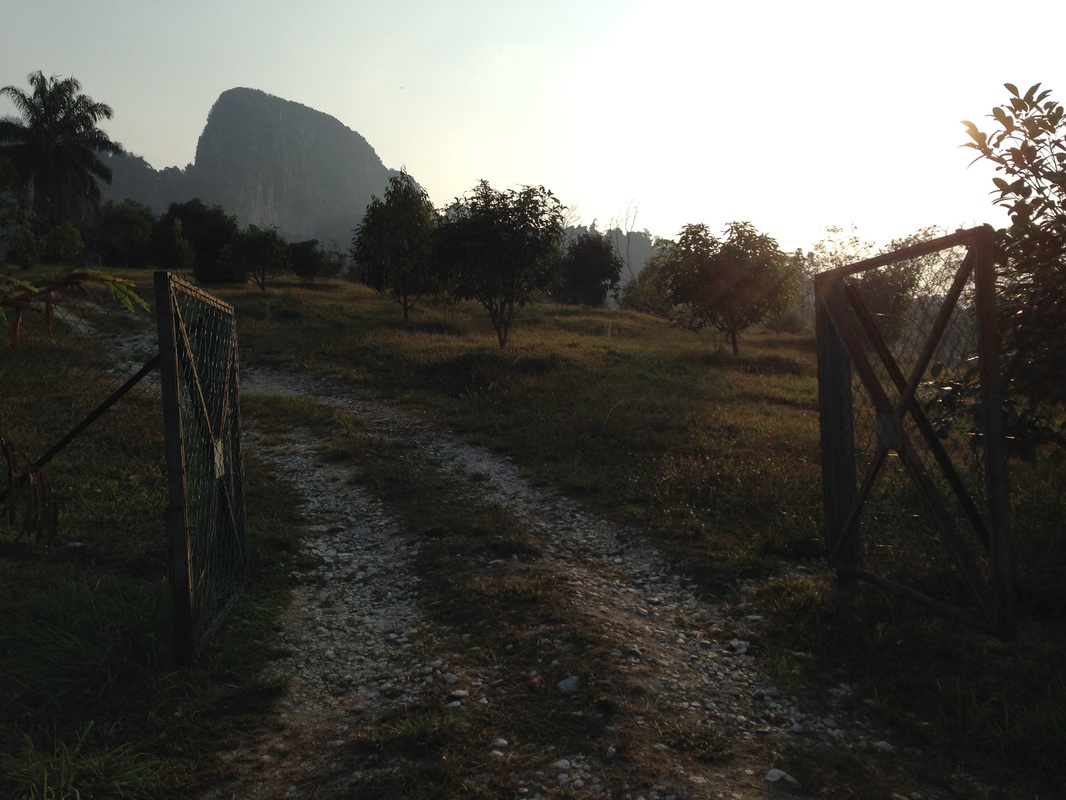
The gate that leads into the farm compound. The gate also frames the peak of Tabur Extreme very nicely in this picture
The trailhead is just after the Sunway Ridgeway housing area. It's worthwhile describing the directions to the trailhead in some detail as we had to manoeuvre through a number of constructions zones and things are clearly fluid - the satellite maps show jungle and foliage and a nice wide path whereas what we actually encountered were construction as far as the eyes could see and the original path has been obliterated in various places.
The ascent starts easy enough but we quickly came to the first rock wall that must be climbed. It's a difficult wall as we need to climb up and to the left. But the drop to the left is large, maybe 30m or so. There are no ropes to hold on, and even if there were, I am not sure if it would be any safer. Immediately after the leftward climb comes another straight up wall climb with not many ledges or roots to hold on to. There is a rope though. We found this section very difficult to negotiate, both on our upward journey as well as on our way downward. A slip would mean a fall of some 30-40m into the forest below. On the way down, both my legs slipped from the meagre toeholds and I was dangling in mid air with only my hands on a root and the rope in a very awkward position. I thought the wall was very risky and don't really relish climbing this again.
The pinnacle in front is that of Tabur East. Further at the back are the peaks of Tabur West. The peaks make a clear straight line cutting through forests of Hulu Kelang
The top of the wall brings us to the highest peak on Tabur Far East at 363m. There are incredible views of Klang Gates lake and the mountains encircling the lake catchment forest. Looking towards the west, the line of quartz dykes that form Tabur East and Tabur West fan out to the far horizon. Climbers on Tabur East can be clearly seen as they summit the highest point and peer down the abyss that separates Tabur East from Tabur Far East. On the east, the pinnacle of Tabur Extreme forms an eerie silhouette against the rising sun.
A backward glance at the highest peak (peak #2) from the next peak towards the west
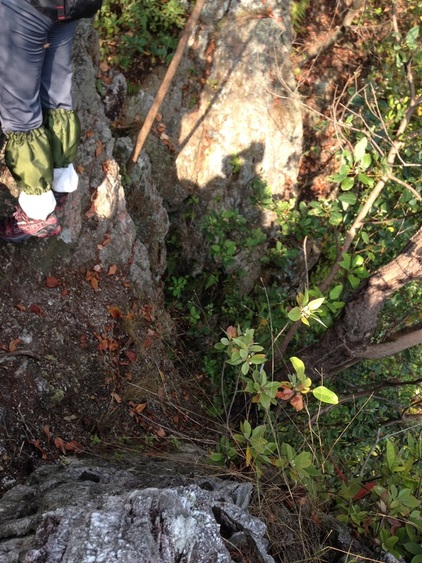 Our turn back point. There is a deep crevice between where we were and the whitish rock on the other side. The crevice is only a few feet across at the narrowest point, but is 20m or more deep (can't see the bottom). And there isn't much foothold on the cliff on the other side to scale up. We didn't dare go further without technical climbing gear
The trail continues further west, but after this point, it appears little used. There aren't any ropes or aids for climbing or descending and yet the rock cliffs that must be negotiated are steep and without much purchase. Up and down we went. We counted in total 7 peaks from the saddle, with peak #2 being the highest. After climbing down from #7, we encountered a deep gorge that has to be crossed before we can climb peak #8. The distance across was only a few feet at its narrowest point, but there wasn't anything on the other side to land on or hold. It was a sheer vertical wall for another 10m upwards. Downwards was at least 20m of drop. Too risky without technical climbing gear, so we turned around. But we could sense that we were not far from Tabur East. My GPS told me that the end of Tabur East was only 30 more meters away behind peak #8.
Like the other Tabur trails, this had no shortage of thrills, vistas and scenery. But it was not much frequented, less than Tabur East and certainly far less than the popular Tabur West. We did not meet anyone during the whole journey, though we spotted climbers on Tabur East far away.
There are rock walls that must be climbed (and descended!), only attempt them if you have the strength and experience. If it looks difficult, then it is. Turn back.
Wear long trousers and gloves, to avoid scratches on the sharp rocks.
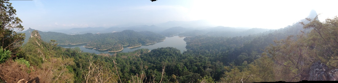
180 degree panorama taken from the top of Tabur Far East peak #2 (highest). On the left are the peaks of Tabur West (far away) and Tabur East. In front are the Klang Gates Reservoir. On the right is the peak of Tabur Extreme. The highlands of the Titiwangsa are not clearly visible due to the hazy conditions
Trail Map and Data
| Location: | Taman Melawati |
| Distance: | 4.1 km |
| Duration: | 3:21 hrs |
| Average Speed: | 1.6 km/h |
| Min Elevation: | 95 m |
| Max Elevation: | 363 m |
| Vertical Up: | 332 m |
| Vertical Down: | 355 m |
Related Posts
- Bukit Tabur West
- Bukit Tabur East
- Bukit Tabur Extreme

