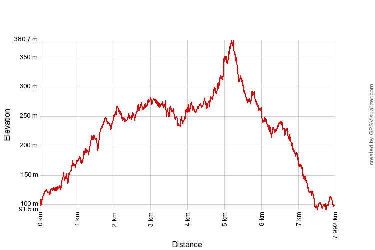
 The pinnacle of Tabur Extreme seen looming above the forest floor
Malaysia, Selangor, Kemensah
380m | 8.0 km | 2:35 hours
Our aim was to climb Bukit Tabur Extreme, the easternmost of the Klang Gate Quartz Ridge. They are apparently two routes to the peak, one from the west, starting from the end of Jalan K5 near Sunway Rydgeway at Melawati, and the other from the east, staring from Kemensah on Jalan Zooview. The route from the west is the same one that leads to Tabur Far East. We initially attempted the west path, but was hampered midway as the gate to the farm was closed and locked. Perhaps it was too early in the morning (about 7.20 am).
So we drove out to Kemensah and attempted to find the way from there. Near the end of Jalan Zooview, there is a narrow road to the left, immediately after a fishing pond. Near the end of this road is a dirt track that goes up the hill on the left. We took this path, and after walking for 15 minutes we began to suspect that it might be the wrong one. And indeed it was. The correct path is an earlier dirt track just before a cafe. Coming from Jalan Zooview, you will see (all on your left) a small tarmac road, then a dirt track, then another small tarmac road (with a sign saying Orang Asli settlement) and then another dirt track. The correct path is the first dirt track.
Take the first dirt track, and it will lead up the ridge. There will be a lone hut with a zinc roof along the way (see pictures). The path splits into two at this point - take a right and continue uphill. The path basically goes parallel to the ridge westwards, on the north side of the peaks. From this path, it looks like there are several paths to the peaks. We came across at least two. The first one was a narrow path, but the next one was a wide (very wide in fact) path. Both of these paths to the peaks had barrier tapes strung across with a sign warning hikers that permits are needed to climb up (see pictures).
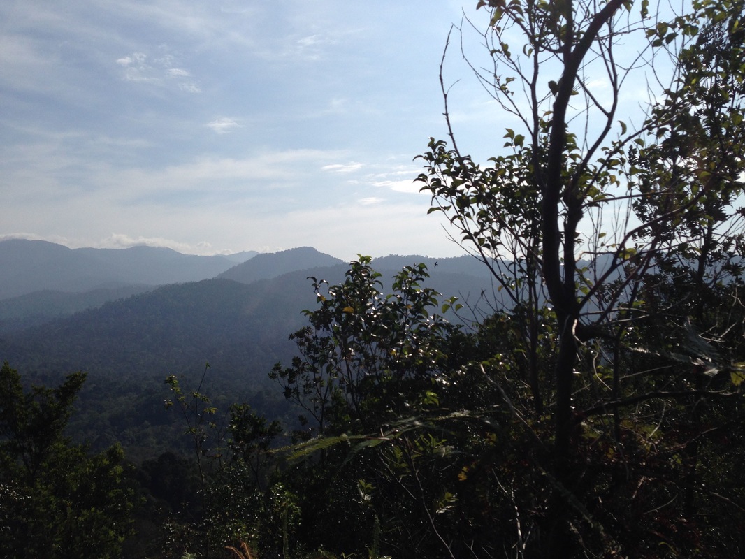
View of the Klang Gates Forest Reserve from one of the hill tops. At the distance are the mountains of the Titiwangsa range
We took the second (wide) path. It quickly led to the peaks. At the top of the track, one could go left to a view with very nice views of both KL and the Titiwangsa mountains. Or one could go right to an even higher point, but with less of a view. Both the left and right paths continue further to the next peaks eastward and westward respectively. We didn't go further than the first peaks on the left and right, and we couldn't tell how far away Tabur Extreme's highest peak is (on the right). When we checked Google Maps later on, it was clear that the highest peak was still a long way off. It might not even be accessible from our path as there seem to be deep ravines separating the portion of the ridge we were in and the portion containing Extreme's highest peak.
But as I said, we took the wrong path!
But as I said, we took the wrong path!
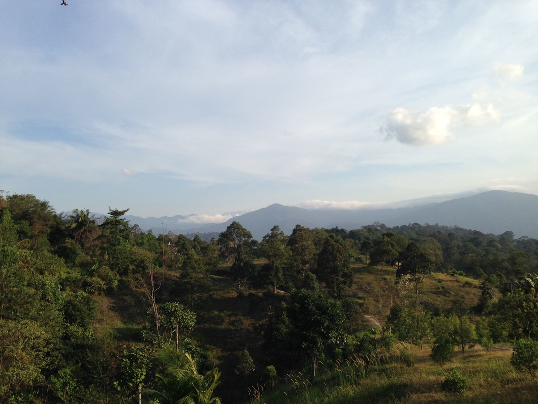
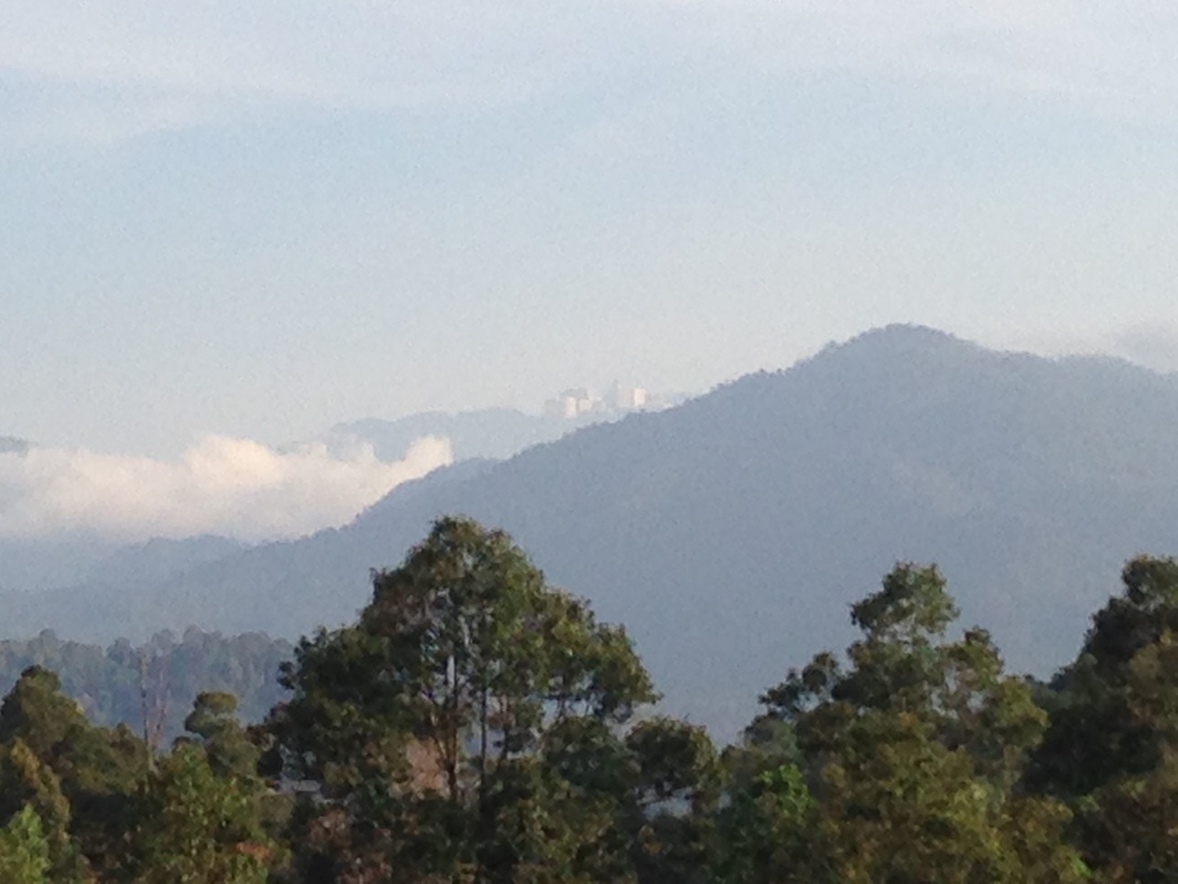
View of Kuala Lumpur from the top
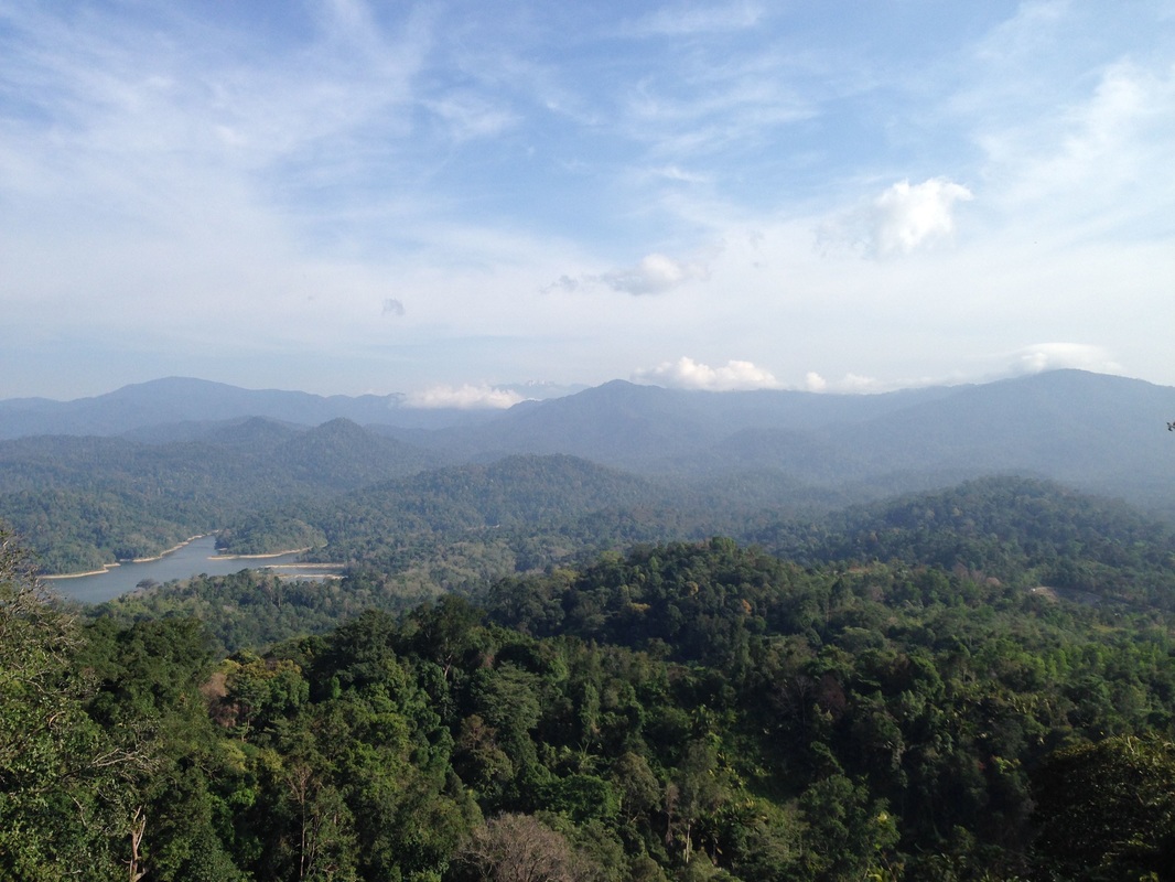
View of Klang Gates Reservoir, the forest reserve and the hills beyond
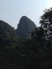
The path we took (the last dirt track) took us into the Klang Gates Reservoir water catchment area. There were many junctions and paths along the way, but we tried to maintain a route that led us towards Extreme's peak.We ended up taking a large circuitious route traversing several hills before joining the path that was parallel to the ridge. The views from the hill tops were spectacular, and one day we must come back again to explore the various routes.
The triangular peak in the middle (mid ground) is Chenuang. Peak of Nuang is at the back, obscured by the clouds
We attempted to find the path that would connect to the "western path", i.e. the one from Rydgeway. In fact we thought that the path parallel to the ridge would eventually join the western path, but it didn't. After the 2nd peak junction, the parallel road veers off to the right and starts heading downhill towards the Klang Gates lake. We explored a number of jungle paths off to the left of the parallel road to see if that would lead somewhere, but it didn't look so (but then we only ventured 100m or so).
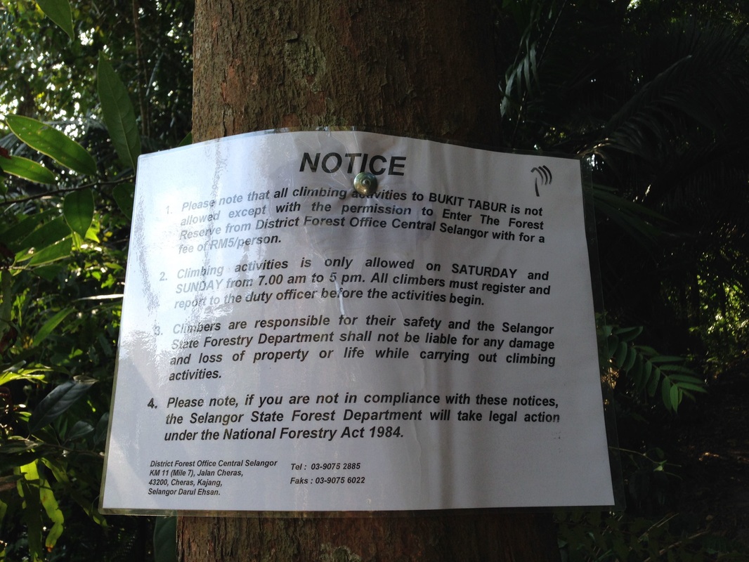
Notice warning hikers of the need to register before climbing
Registration is now required to climb Bukit Tabur. Register at Central Selangor District Forest Office at KM 11, Jalan Cheras. Tel: 03 9075 2885. Permits costs RM 5 per person. Climbing is only permitted on Saturdays and Sundays, 7 am to 5 pm.
Close-up of the buildings on Genting Highlands
Trail Map and Data
| Location: | Kemensah |
| Distance: | 8.0 km |
| Duration: | 2:35 hrs |
| Average Speed: | 3.3 km/h |
| Min Elevation: | 91 m |
| Max Elevation: | 381 m |
| Vertical Up: | 550 m |
| Vertical Down: | 550 m |