 Lower Ampang Waterfall
Malaysia, Selangor, Kemensah
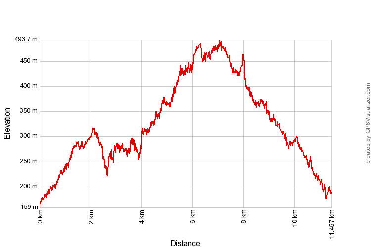
493m | 11.7 km | 3:55 hours
This was a reconnaissance exercise to see what lay beyond the end of Jalan Zooview in Kemensah. We knew from the internet that there were trails to waterfalls, and trails leading up to the hills. We didn't quite know what we will discover or what the condition of the trail will be.
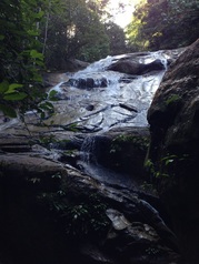
We headed out to Jalan Zooview, the road right next to Zoo Negara. When we were young, the road led to Aquarium Negara which was just behind the zoo. The zoo was otherwise surrounded by jungle. It was therefore a surprise for me to see that Jalan Zooview is now a rather long road that took us past housing areas, then villages and finally the countryside. Near the very end of the road, just before the gate into Institut Budaya Baru Malaysia there is a path that veers off to the right of the road. This is the start of our trek.
493m | 11.7 km | 3:55 hours
This was a reconnaissance exercise to see what lay beyond the end of Jalan Zooview in Kemensah. We knew from the internet that there were trails to waterfalls, and trails leading up to the hills. We didn't quite know what we will discover or what the condition of the trail will be.
We headed out to Jalan Zooview, the road right next to Zoo Negara. When we were young, the road led to Aquarium Negara which was just behind the zoo. The zoo was otherwise surrounded by jungle. It was therefore a surprise for me to see that Jalan Zooview is now a rather long road that took us past housing areas, then villages and finally the countryside. Near the very end of the road, just before the gate into Institut Budaya Baru Malaysia there is a path that veers off to the right of the road. This is the start of our trek.
Trailhead off to the right of Jalan Zooview just before the Institut Budaya Baru Malaysia gate
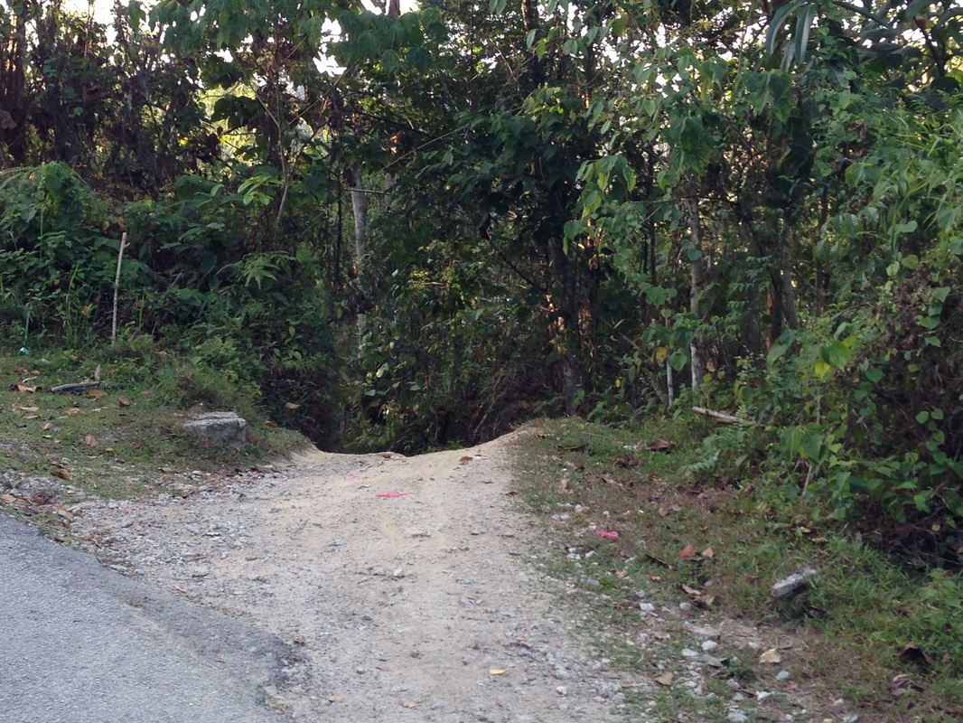
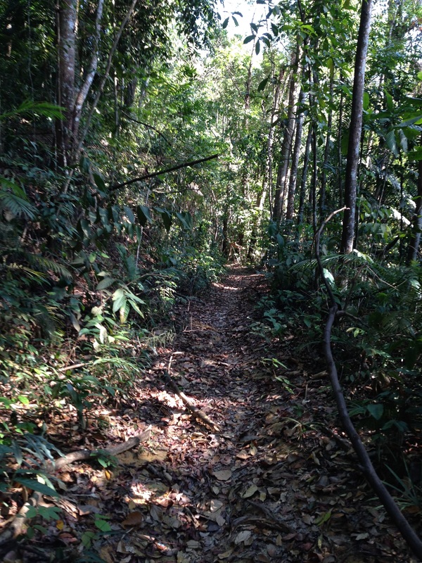
It's a wide, packed-earth path. You can drive a 4 wheel drive vehicle into it. It seems to be a popular track frequented by mountain bikes, scramblers and ATVs. It isn't deeply rutted though, which was good.
Next major junction at the "high point". Straight path continues downhill towards the waterfall. Trail to the left leads up the hill heading northeast.
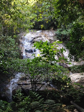 Lower Ampang Falls
We made good time on the well maintained track. In just a few minutes we had covered 1.3km and came to a junction. The main track takes a sharp left turn while the path heading straight appeared to be much less used. When we did the trek from the Old Ampang Reservoir and headed on the road to north, we speculated whether that path will eventually reach the zoo road, and here we were looking at a path that seemed to be going from the zoo road southwards to exactly the direction of the Old Ampang Reservoir! Certainly something to check out in the future, but for now, we kept to the main trail and took the left turn.
The path rose steadily and after another 0.8km we reached another major junction. The main path seemed to head straight while another less-used path stood on the left. This junction seemed to be the high point on the main ATV trail. We had climbed from about 166m elevation at the starting point to about 312m at this junction. The main trail now started heading downwards. We soon reached a rather large waterfall, apparently the lower Ampang fall. Now if this stream really is the Ampang River, this is quite fascinating because Google Maps shows Ampang River ending at the Bukit Belacan Reservoir some 12km south of this place.
The path rose steadily and after another 0.8km we reached another major junction. The main path seemed to head straight while another less-used path stood on the left. This junction seemed to be the high point on the main ATV trail. We had climbed from about 166m elevation at the starting point to about 312m at this junction. The main trail now started heading downwards. We soon reached a rather large waterfall, apparently the lower Ampang fall. Now if this stream really is the Ampang River, this is quite fascinating because Google Maps shows Ampang River ending at the Bukit Belacan Reservoir some 12km south of this place.
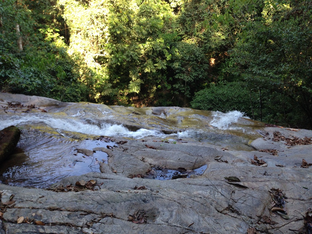
View from the top of the waterfall
Nosing around the waterfall revealed some interesting things - there were old pipes along the stream, now broken and badly corroded. I couldn't imagine why the pipes were there and simply just speculated that it was some haphazard work of someone to perhaps supply water to a camp nearby. But I am certain now that I am wrong.
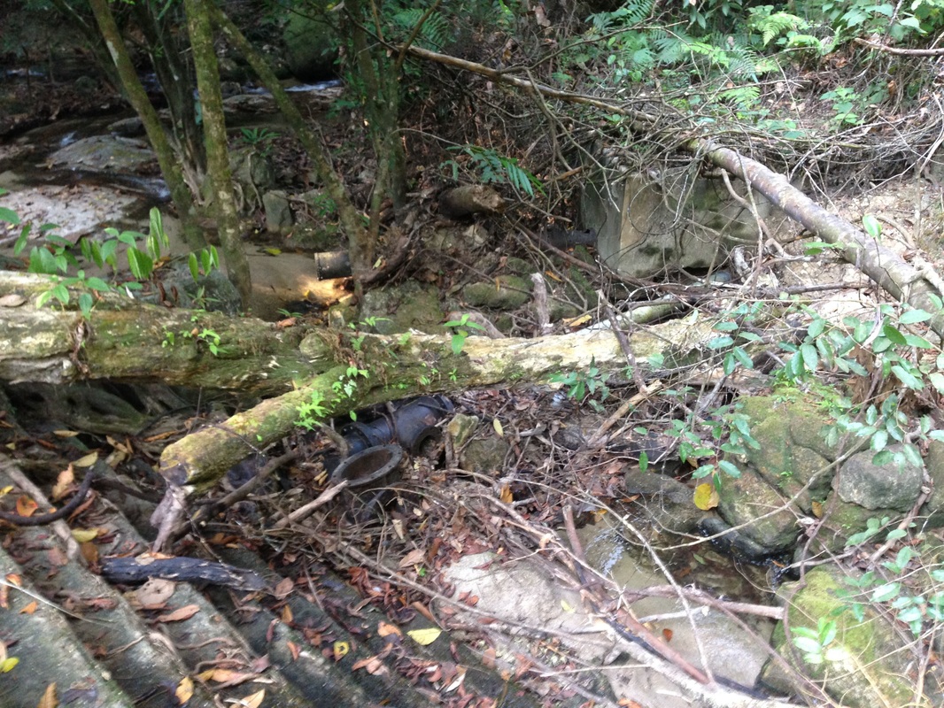
The concrete dam with some of the pipes visible
The trail continued on the left of the waterfall up to the top of the waterfall. The trail continues a little further to a campsite where there is a makeshift "tent" made of two zinc roof sheets. Next to the campsite, on the right is the river. To my utter surprise, we saw that the river had been dammed. There was a series of old concrete bunds about 6 feet high holding the river back! Remains of some sluice gates can be seen. It appears to be a water supply work where water from the dammed river is piped downriver. Remains of pipes are all around, and they seem to be heading in the direction of the waterfall, probably taking water from here all the way down the river to some water station. The river upstream of the dam has now all silted up with the dam only holding a few inches of water.
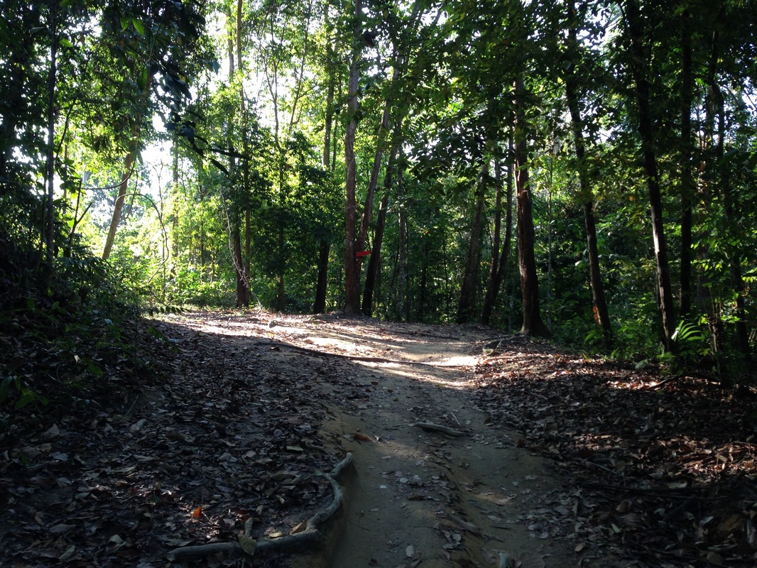
Condition of the trail that lead north from Kemensah
|
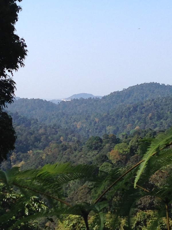
View of a mountain peak beyond the mountain in Ampang Forest Reserve, with signs of some mountain cutting on the side.
|
We walked on the river bed up stream for a few minutes and then turned back as we didn't want to get our shoes wet. Apparently there is an even larger waterfall some "100 feet high" about an hour upstream. Something for another day!
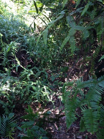 Our trail, now just a narrow squeeze between dense undergrowth
We made our way back to the "high point" junction and then proceeded to explore the other path. This path continued uphill. It was initially an easy trail, wide and flat enough for an ATV or 4WD. But the path hasn't been used much and the jungle is claiming it back. There are numerous landslips along the way, and each slip made the path beyond that point even less used and therefore overgrown with thorny undergrowth.
The going got harder and harder, at several points we had to hack through fallen trees, shrubs and vines that were blocking the way. After about 2.6km, the path which had been steadily going uphill reached what appeared to be a high point and then started going downwards. We turned back as we had to return for lunch. The highest point we reached was 483m above sea level, probably the highest I have ever been around KL.
We don't know where the trail leads to. It was heading in the direction of Gunung Chenuang, and I have heard that there is a trail to Chenuang from Kemensah. Perhaps this is the trail. But it is strange that the trail is not just a jungle path. This is a track that was originally wide enough for a 4WD. What reason could there be to create such a track? I am wondering if there is some kind of ranger station or disused telecommunications tower or water works further on for which this path was the access road. It would be fantastic to push further next time.
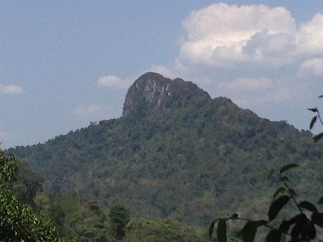
View of Bukit Tabur Extreme, sighted on the way back to trailhead
So plenty to further explore next time: this track into the hills, follow the river bed further upstream, and the track going south towards the Old Ampang Reservoir.
Trail Map and Data
| Location: | Kemensah |
| Distance: | 11.5 km |
| Duration: | 3:55 hrs |
| Average Speed: | 3.3 km/h |
| Min Elevation: | 159 m |
| Max Elevation: | 493 m |
| Vertical Up: | 704 m |
| Vertical Down: | 678 m |