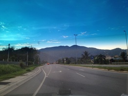
 View of Gunung Angsi seen from the LEKAS highway
Malaysia, Negeri Sembilan, Seremban
809m | 9.5 km | 3:10 hours
Seremban is surrounded on three sides by hills and mountains. In the north, separating Seremban from Nilai is Bukit Gallah and Bukit Penda. To the west, standing between Seremban and Jelebu are the Berembun mountains. And to the south is Gunung Angsi, a prominent mountain that is clearly visible from Seremban town.
Gunung Angsi is located within the Angsi Forest Reserve. There are a number of routes up to the peak, the most popular being the one from Ulu Bendul Recreational Park. This takes just under 3 hour to ascend. The second path is from Bukit Putus. This is shorter, about 2 hours, and is an easier route to the peak. One can also do a trans-Angsi hike, starting from Ulu Bendol, climbing up to Angsi and descending to Bukit Putus. The problem with this is that one will have to walk back to the Ulu Bendul starting point to collect the car, a distance of 4 km or about 45 minutes on Jalan Kuala Pilah.
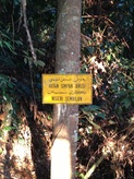 Signboard at the beginning of the trail marking the Angsi Forest Reserve Signboard at the beginning of the trail marking the Angsi Forest Reserve
There is a third route from Seri Pajam near Senawang, but it's less oft used. We used the Bukit Putus route.
To get to the trail head, take the Lebuhraya Kajang Seremban (LEKAS) from Kuala Lumpur to Seremban. The expressway ends in Seremban, at the junction with Jalan Kuala Pilah (Route 51). At the junction, turn left towards Kuala Pilah. Carry on driving on route 51 for 8.2 km (about 7 mins) until the junction with the old Kuala Pilah road is reached. Turn right into the old road and drive for about 1.2km. There will be a small booth which marks the start of the trail. On the right will be some space where one can park the car. The trail head is on the left, it's just some concrete blocks across the road-side drain and a path cutting up the steep slope. |
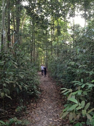
The beautiful trail with wide leaf strewn path
|
The trail is wide and pretty in many parts with lots of fallen leaves covering the path. But it is rather steep and relentless for the first 1.5 km. Along the way, there is a rest area with a sort of cafe where food and drinks are sold. There are also chairs and tables if you want to take a break.
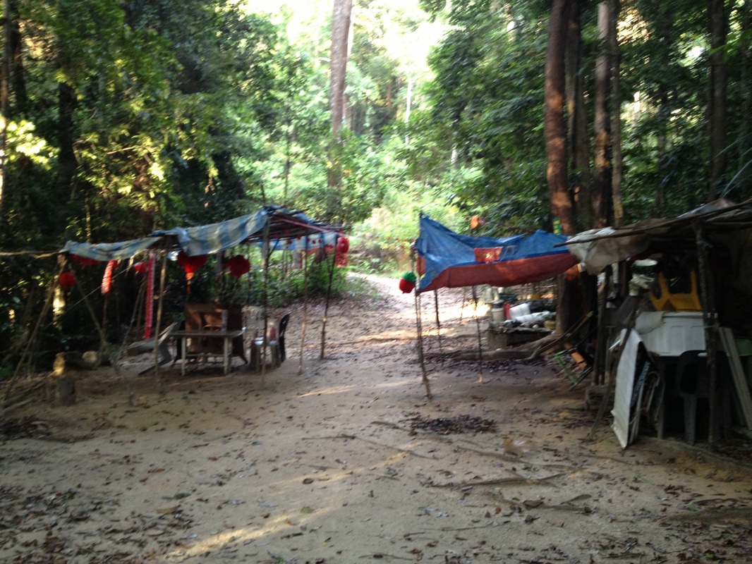
The rest area where one can get drinks
After this point, the path splits into two. One goes straight ahead up a hill. and the other goes to the right circumventing the hill. We took the path to the right, which seems an easier one. They both join again after the hill.
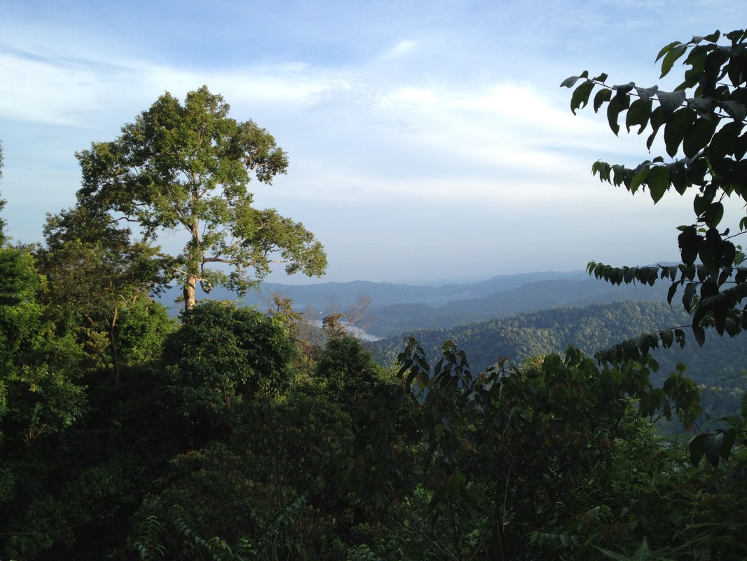
Scenery to the north from a break in the tree cover along the way. The Linggi reservoir can be seen in the middle of the picture. The mountains to the right are the Berembun mountains. The highest peak to the extreme right of the picture, at the back of the leaves is the Berembun peak
The climate along the way is cool, breezy and very pleasant. There are some views along the way, but nothing spectacular. After about 1.5 hours, we reached the peak. There is the customary beirut there but not much views.
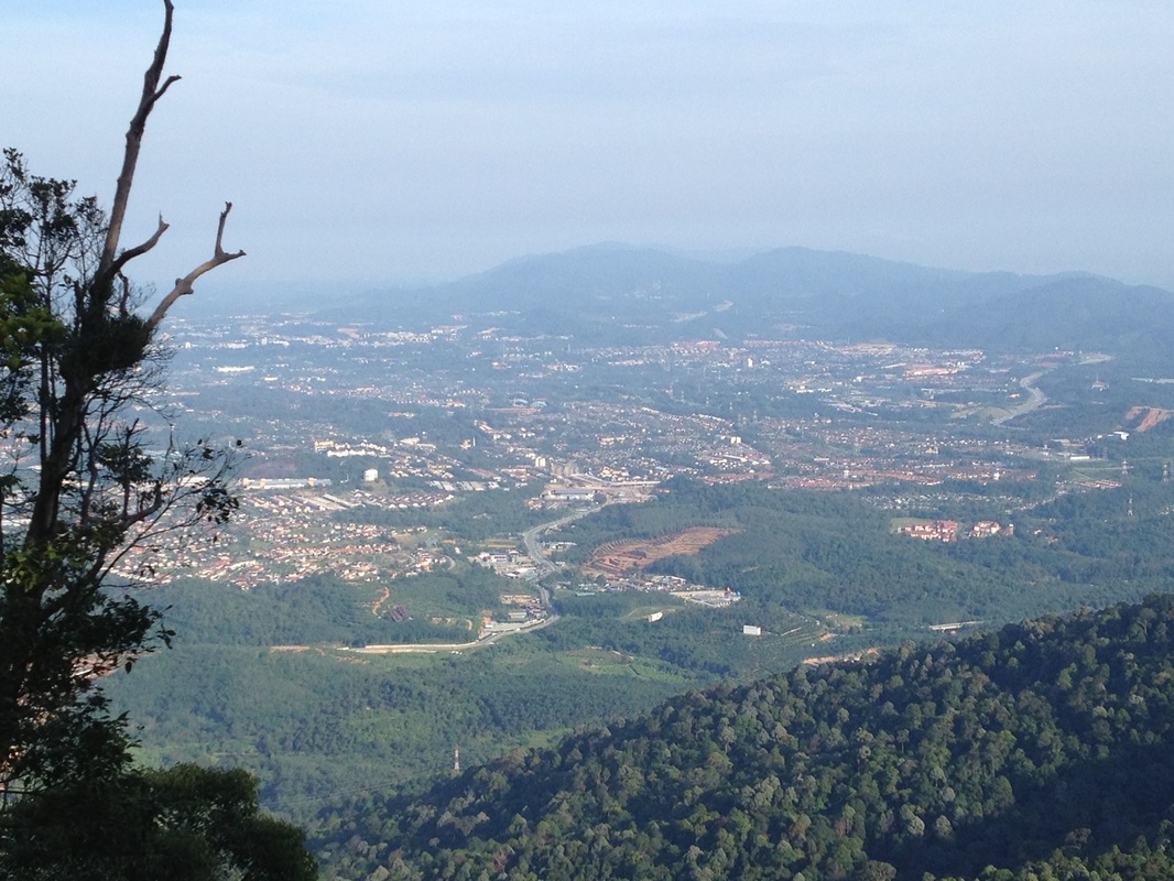
View of Seremban town. The main road in the middle of the picture is Jalan Kuala Pilah. The messy built-up area just to the top of Jalan Kuala Pilah is the junction between LEKAS and Jalan Kuala Pilah which is still under construction. The two mountains at the background are Gunung Gallah and Gunung Penda. Seremban town centre itself is at the top-left
We took the same way down, reaching the car in about another 1.5 hours.
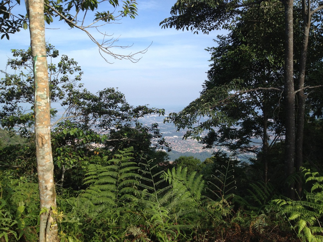
View from the peak of Seremban town
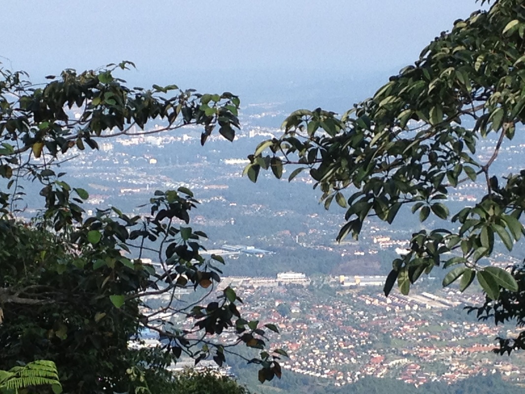
A better view, but still not as good as the one from a little below
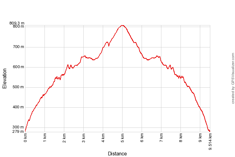
Trail Map and Data
View map fullscreen | View on Everytrail | Download GPX file
| Location: | Seremban |
| Distance: | 9.5 km |
| Duration: | 3:10 hrs |
| Average Speed: | 3.0 km/h |
| Min Elevation: | 279 m |
| Max Elevation: | 809 m |
| Vertical Up: | 657 m |
| Vertical Down: | 654 m |
Related Posts
- Gunung Angsi (via Ulu Bendul)
- Bukit Penda
- Bukit Galla

