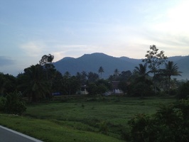
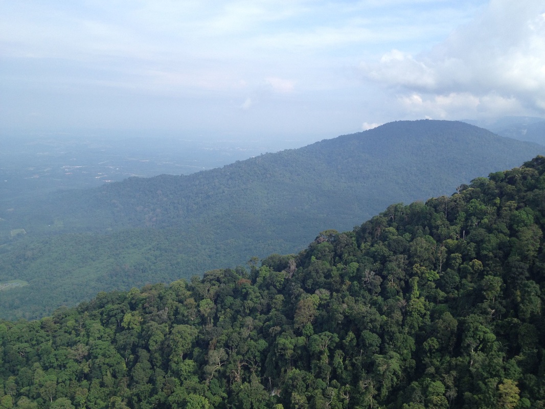
 View of Gunung Datuk/Rembau from the south. Gunung Rembau peak is the highest point in the middle. I believe the Gunung Datuk boulder plateau is the tiny bump just to the left of the highest point.
Malaysia, Negeri Sembilan, Rembau
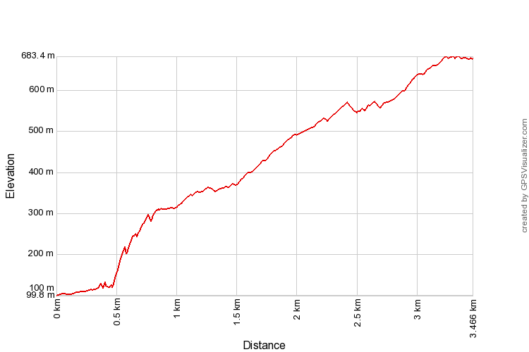
683m | 3.5 km | 2:34 hours
Gunung Datuk is really a rocky ledge about two thirds up the way to the true peak, Gunung Rembau. It's located within the Gunung Datuk forest reserve near Rembau town in Negeri Sembilan. Although Gunung Datuk is only 683m in height, it offers however a panoramic view of the surrounding area.
Getting to the trailhead is easy: Head south on the North-South expressway from Kuala Lumpur towards Johor. Exit at Pedas. Immediately after passing the toll plaza, turn left at the T-Junction. At the next junction, a round-about, turn to three o'clock. This road will lead to and join the old north-south trunk road (Route No. 1). Upon reaching the trunk road, turn right and head towards Rembau town. Continue on the road, passing the rail-road tracks and then the town itself. About 5 km after Rembau town, just before another bridge over the train tracks, turn left onto road N111. After another 5km, turn left onto a small track through some orchards. There are signs showing where the turn-off is. The track will lead to the Gunung Datuk forest reserve park headquarters from where the trail head starts.
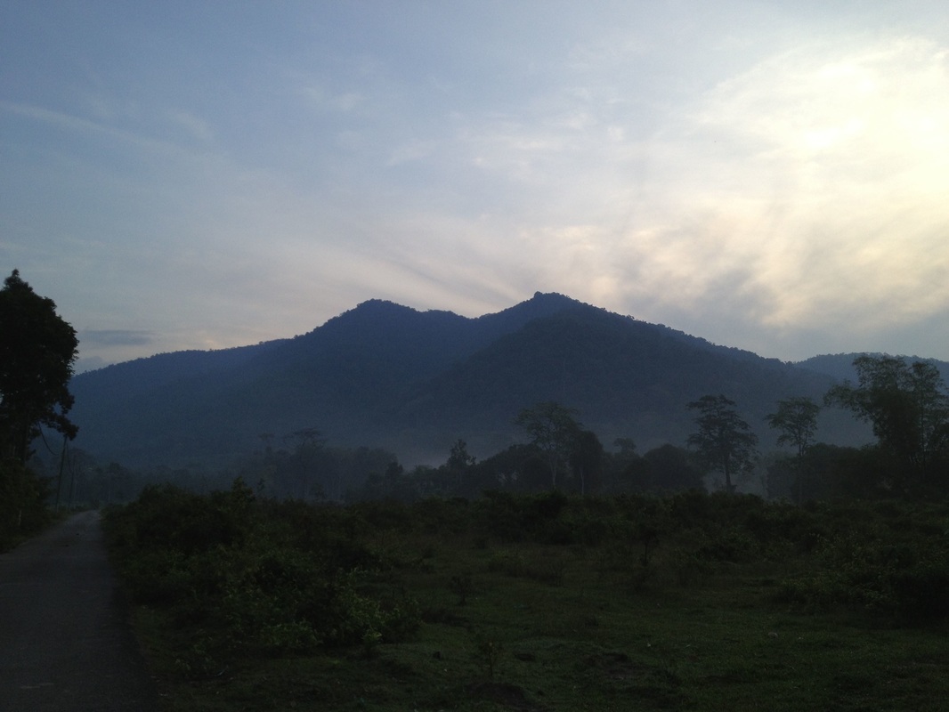
A better view of Gunung Datuk from the west. The Gunung Datuk boulder ledge can be clearly seen just to the left of the tallest point
The trail starts with a short downhill stretch down to the stream beside the park headquarters before crossing a bridge and then going up. At this point the concrete path appears to lead up to the left, but the correct path is actually an earth trail on the right. This is perhaps the only part of the whole track that is a little confusing.
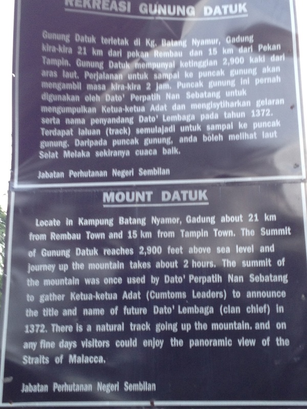
A plaque at the Gunung Datuk forest reserve park headquarters describing the legend behind Gunung Datuk
|
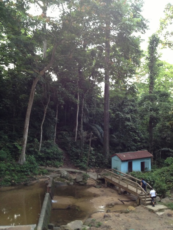
The start of the trail. After crossing the bridge, there is an earth path to the right. Follow this earth path, and not the concrete path to the left
|
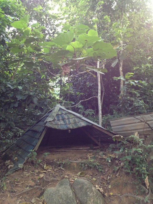
First rest area after the long, steep hike up from the starting point.
|
The trail first passes a park hut and then through a boulder section where there are giant rocks on both sides of the trail. If you go through these, you know you are on the right track. The uphill climb is steady and fairly steep. There are enormous trees in the lower parts of the mountain, including one that appears to have been partly sawn through. But the tree survived and grew back, covering over the sawn section. It's an interesting climb with lots of sights to occupy the eye, including trees with giant roots. The trail is very clear and easy to follow
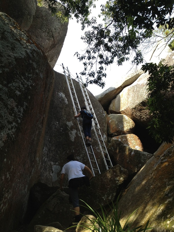
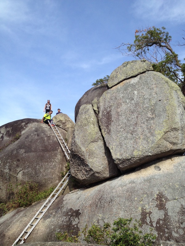
The ladders to ascend to the top of the Gunung Datuk boulders
|
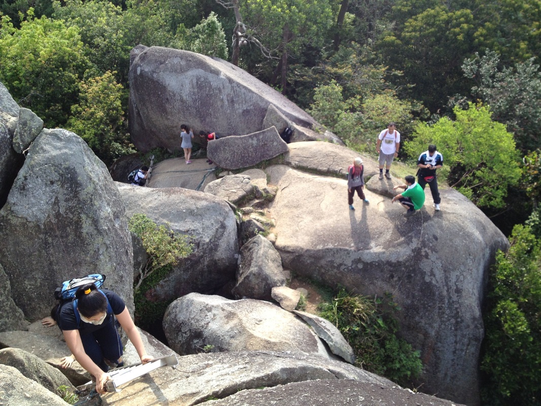
View of the boulders
|
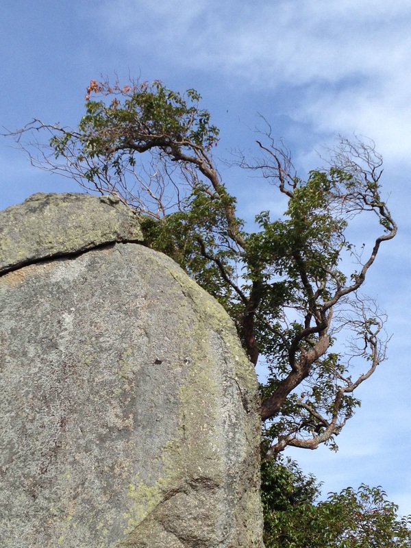
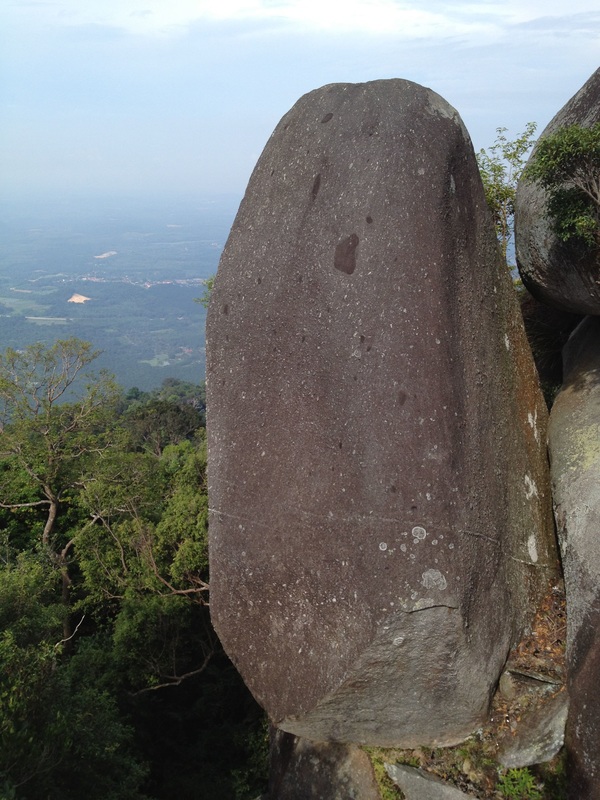
The highest boulder
|
Although it's only 3.5 km, the climb is quite strenuous, particularly the first half. After the first rest-area, the trail turns left and becomes less steep. At the top is a small flat clearing where tents could be set up. Just to the left of the clearing is a rocky ledge made of of giant boulders. The ledge overlooks the lower grounds to the west. There is a set of ladders which can be used to climb up the boulders and on to the view-point area at the top. The view is well worth the climb, and on a clear day, I presume one can see all the way to the Malacca straits
A large boulder on the side of Gunung Datuk
|
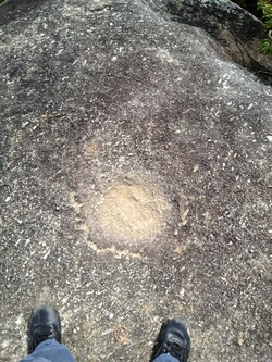
A small depression on the top of the highest boulder of Gunung Datuk. According to legend, this is the footprint of Hang Tuah
|
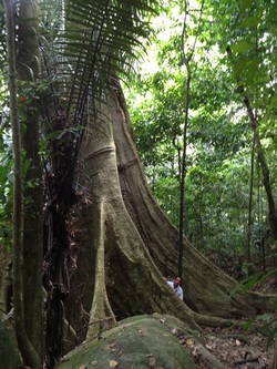
A giant tree with massive buttress roots. Compare the size of the tree with that of a human peaking from behind one of the buttresses
|
The highest boulder has a strange foot-print like depression at the top, which according to legend is the foot print of Hang Tuah himself.
View of the boulder plateau from the top of the highest boulder
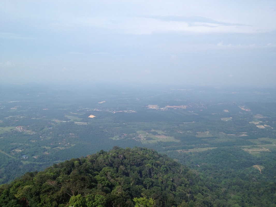
View from the boulder to the south-west. in the foreground is the main road, N111. Behind that, in the midground are the train tracks. Further behind is the North-south highway. Far in the horizon should be the Malacca straits, though not visible here. But the Linggi river can be just about seen in the middle of the picture, leading away to the straits
|
View to the north-west in the direction of Rembau town (not visible due to the hazy condition). The peak on the right side is Bukit Besar, a 650m peak just north of Gunung Rembau
|
At the camp-site clearing, there are two other paths, one leading to the Rembau peak, and the other seemingly leading down although I do not know where it leads to.
All-in, Gunung Datuk is one of the more rewarding hikes as it is relatively short and easy to follow, but at the same time has many interesting sights along the way AND a very satisfying view at the top.
A hike to Gunung Datuk, which is really a lower peak before the true peak, Gunung Rembau. Datuk offers great views to the west, all the way to the Malacca Straits on a clear day.
Trail Map and Data
View map fullscreen | View on Everytrail | Download GPX file
| Location: | Rembau |
| Distance: | 3.5 km (one way) |
| Duration: | 2:34 hrs |
| Average Speed: | 1.4 km/h |
| Min Elevation: | 100 m |
| Max Elevation: | 683 m |
| Vertical Up: | 632 m |
| Vertical Down: | 54 m |
Related Posts
- Gunung Rembau

