 A peek at Gunung Ulu Semangkok, from Gunung Gap
Malaysia, Selangor, Gap
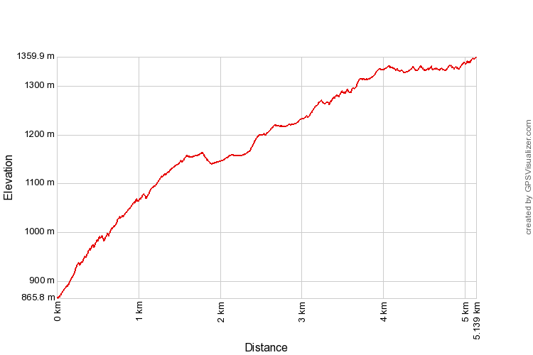
1360m | 5.1 km | 3:13 hours
Gunung Ulu Semangkok should not be confused with Gunung Semangkok. Although both are peaks on the Titiwangsa range on the border between Selangor and Pahang, Ulu Semangkok is on the south of Frasers Hill while Semangkok is to the north. It is curious that the two peaks bear similar names. The Semangkok river, a tributary of Sangloi river (itself on the upper Selangor river) has its origins on the west of The Gap. Indeed, the earlier name for Gap was Semangkok Pass. Ulu Semangkok is situated just to the south of the Semangkok Pass and forms the highest peak in the vicinity. Ulu Semangkok therefore is an apt name for the mountain as Ulu means river head in Malay, and Ulu Semangkok is exactly the highest mountain at the head of the Semangkok river. But what about Gunung Semangkok? It is not on the Semangkok river basin, nor the Sangloi and not even the Selangor river. In fact it is drained by tributaries of the Bernam on the western slopes and Sungai Sepam on the east. So why is it called Gunung Semangkok?
The entrance to the trail head. Note the laminated paper sign indicating the trail
|
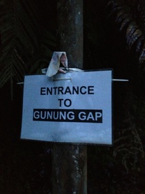
The laminated paper sign!
|
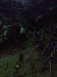
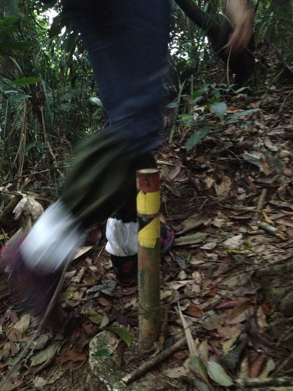
The trail is a little hard to see, starts off almost like a cave under the bushes. There is a short, steep section at the start which requires scrambling with hands on the muddy slopes. Just above this is a dense bamboo forest
|
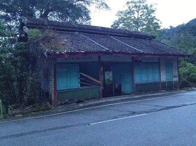
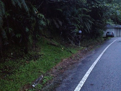
The row of abandoned shops just opposite the trail entrance. This is your obvious marker
|
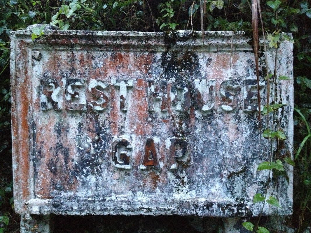
The stone signboard for the now abandoned Gap Resthouse
|
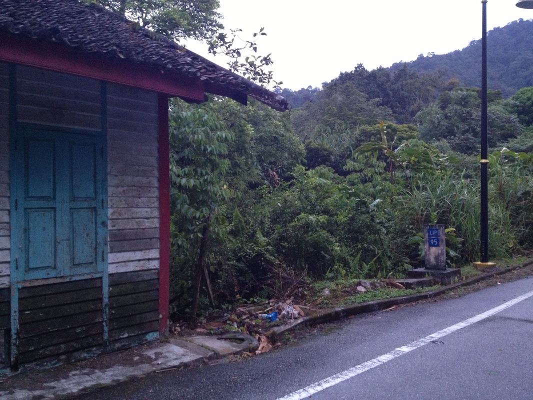
The trail entrance is exactly opposite this milestone (95 km to Kuala Lipis) which is just after the shophouses if one is coming from KKB. You can't miss this
|
I couldn't find any reference to this and if anyone knows please let me know. The forests on the western side are known as Kuala Gading reserves. The rivers, all tributaries of the Bernam, are Inki, Gading, Perah, Lempung and Lubuk Kawah. Nothing related to Semangkok.
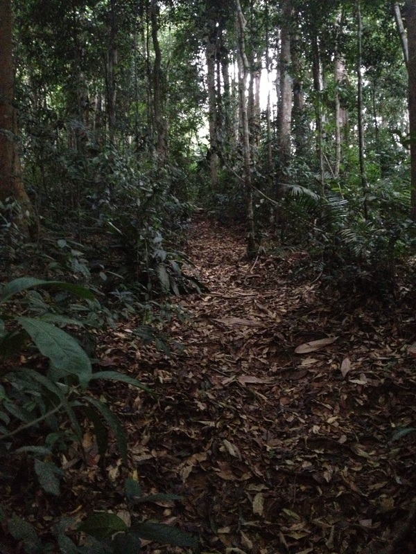
A beautiful wide trail once one passes the initial mud climb and bamboo forests
|
Border marker between Selangor and Pahang. There are lots of these all along the trail as the trail runs essentially on the boundary between the two states
|
My suspicion is that the mountain chain between Gap and Gunung Bernam in the north was poorly explored due to their extreme remoteness and did not have commonly known names. And it was only after tin mines were opened during the 1890’s in what is now Fraser's Hills that the whole section of the mountain range was referred to as the Semangko mountains as they were accessed via a steep track from the Semangkok pass. Many references to this can be found in writings from the turn of the 19th century which refers to today's Fraser's Hills as Semangkok Mountains. After the mountain hill station was opened in 1922, Fraser's Hills was renamed after its early miner-explorer, Louis James Fraser while the rest of the mountains further north retained the Semangkok Mountains moniker. The highest peak of which was named Gunung Semangkok.
But I digress.
But I digress.
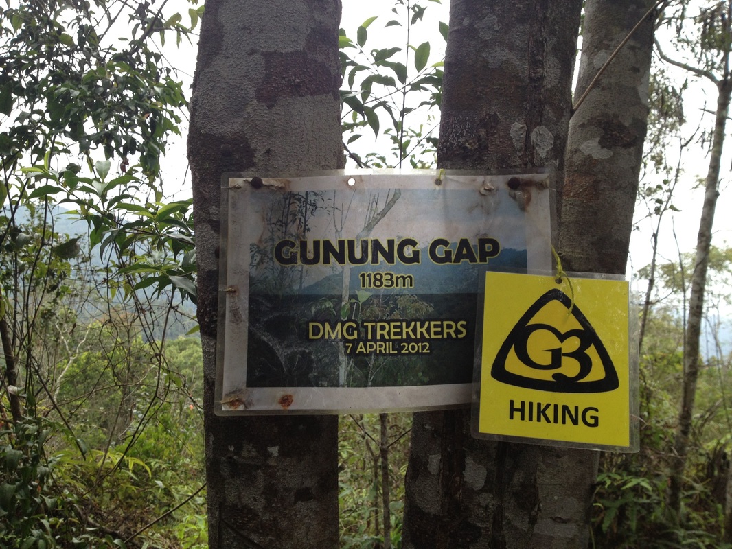
Finally, Gunung Gap. There is also a stone boundary marker at the peak
|
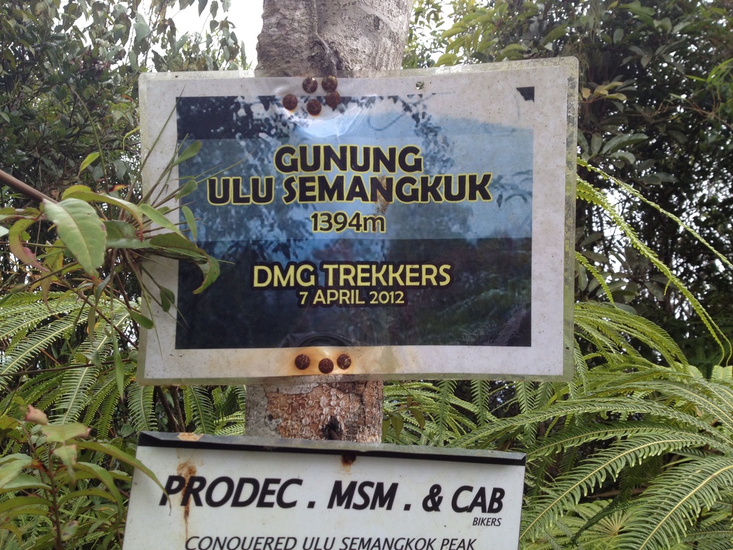
The laminated paper signboard at the peak of Gunung Ulu Semangkok
|
The trail head to Ulu Semangkok starts at the Gap, just before the Gap Resthouse. If one is driving up from KKB, you'll encounter a line of abandoned shops on the left kerb of the road just before the rest house. The trail head is immediately after the shops, on the opposite side of the road. It's just a break in the under growth, almost a hole in the tall bushes, with a small A4 sized note at the entrance marking it as the start of the trail. The entrance requires some scrambling up the steep sides of the hill as a result of the hill cutting done during the construction of the road. The initial part is full of bamboo and thorny plants but soon becomes a distinct but still rather steep path. After a few minutes of climbing, we reached the crest of the hill and we could see border marker stones demarcating the boundary between Sleangor and Pahang. The trail simply goes along the crest until we reach a peak called Gunung Gap. There’s a stone there marking the peak.
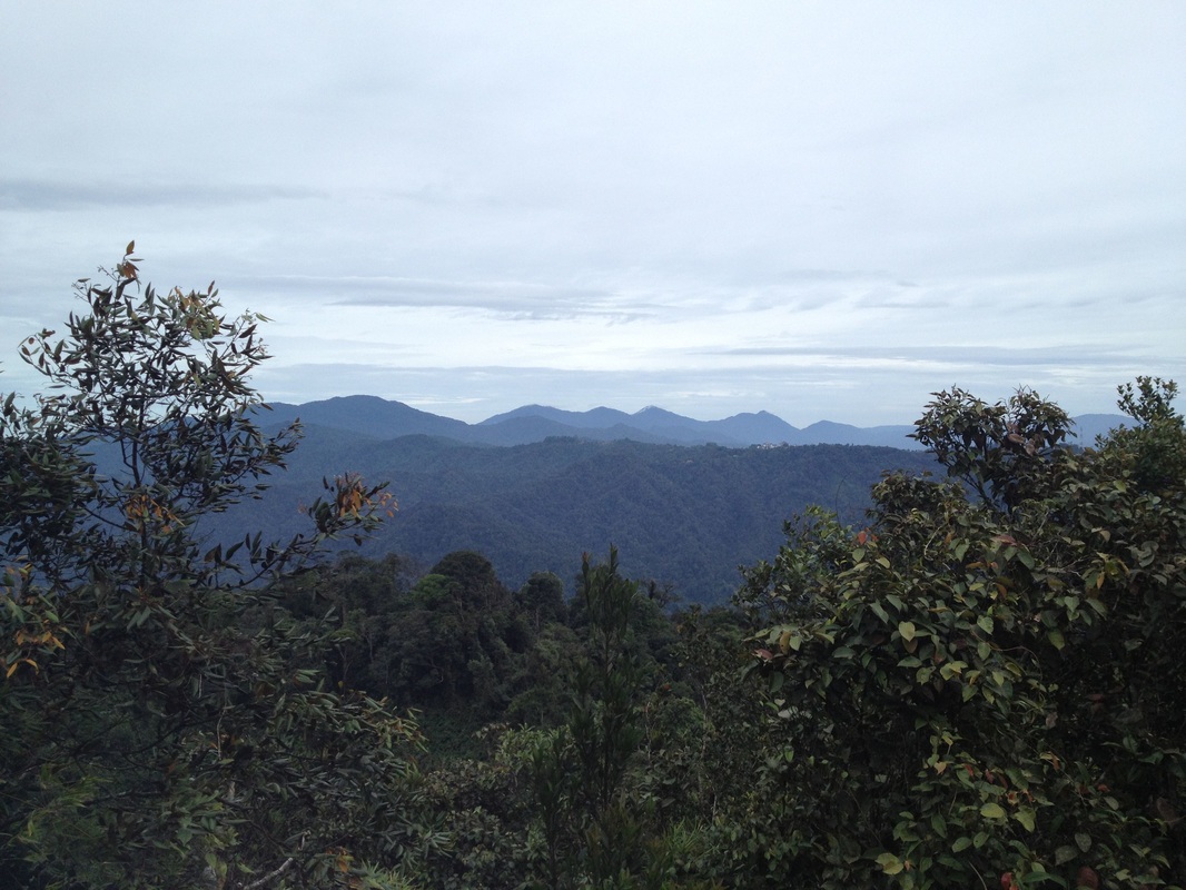
A fantastic view of the Titiwangsa peaks to the north from Ulu Semangkok peak. The leftmost high peak is Pine Tree Hill. The shorter peak to the left of it is Twin Peak. The row of peaks to the right of Twin Peak are the Semangkok peaks, with Gunung Semangkok being the (probably) third one. The buildings of Fraser's Hill can just be seen at the top of the lower hills in the middle of the picture
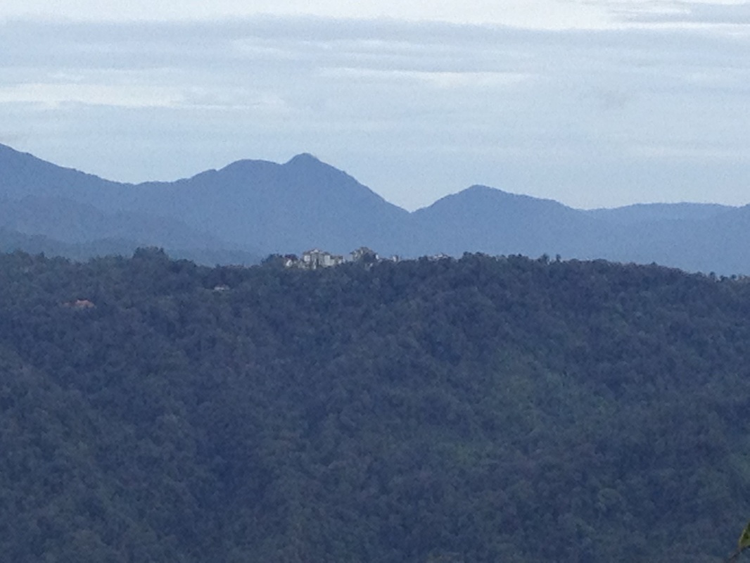
A close-up of the Fraser's Hill buildings
From there, we can go further on to the true peak in the vicinity - Gunung Ulu Semangkok. The trail first leads down to a saddle before it starts going up again. The climate at the top of Ulu Semangkok is windy and cold. It’s difficult to stay still for long without getting chilled. There is a view point near the peak that affords very good views of the mountains to the north, including Frasers Hill, Pine Tree Hill and Gunung Semangkok far away.
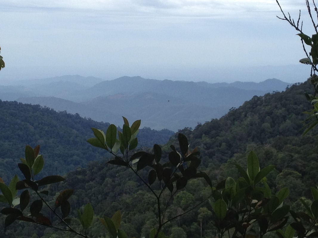
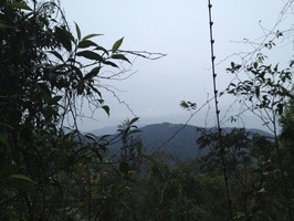
Mist covered hills spotted to the East along the way down from Ulu Semangkok (immediately after passing Gunung Gap). Just barely visible in the far background is a shadowy silhouette of a very high mountain towering over everything else. This I believe is faraway Gunung Benum, a 2107m beast deep in Pahang
Trail Map and Data
View map fullscreen | View on Everytrail | Download GPX file
| Location: | Gap |
| Distance: | 5.1 km (one-way) |
| Duration: | 3:13 hrs |
| Average Speed: | 1.6 km/h |
| Min Elevation: | 866 m |
| Max Elevation: | 1360 m |
| Vertical Up: | 555 m |
| Vertical Down: | 64 m |
Related Posts
- Pine Tree Hill

