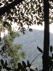
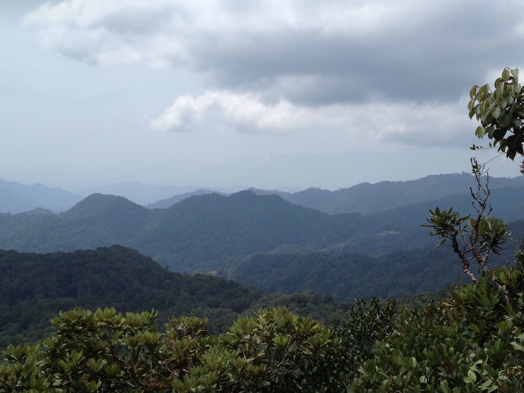
 A view back to Pine Tree Hill on the journey home
Malaysia, Pahang, Frasers Hill
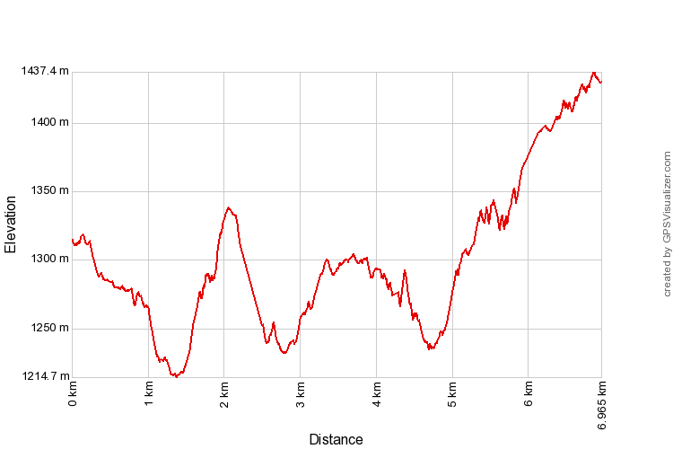
1453m | 7.0 km | 4:04 hours
This trip was to commemorate our first anniversary since the Sunday Trekking Group got together. Our first trip was a walk up Fraser's Hill from Gap and it was only fitting that we celebrate with another hike at Fraser's!
It was an overcast day with a lot of moisture in the air. It didn't help that the past few days were rainy ones, the path was wet and muddy making our journey slow and laborious. From our previous experience with Pine Tree, we know it can be a lovely trail with its wide dry-leaf covered paths and wood lined steps. But today, the slippery floor made it so much less pleasant and a few of us found it quite tiring.
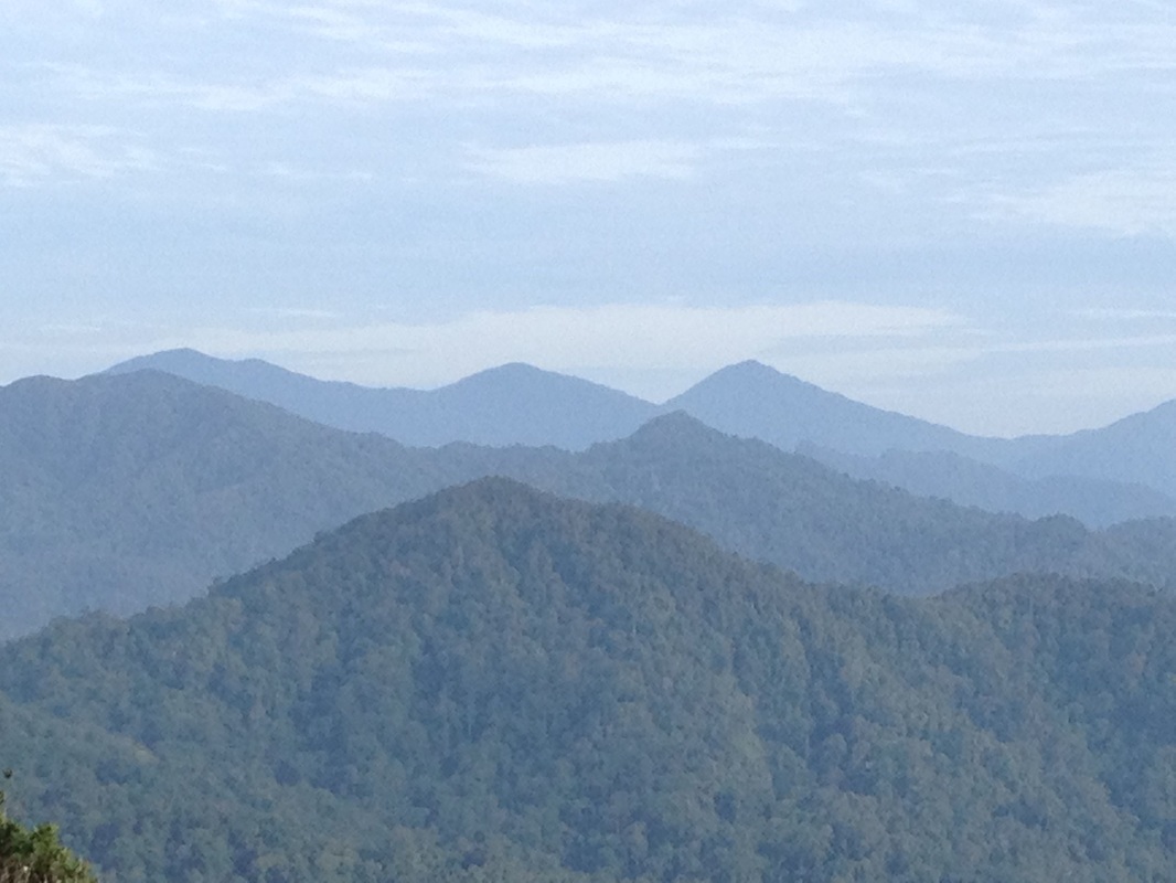
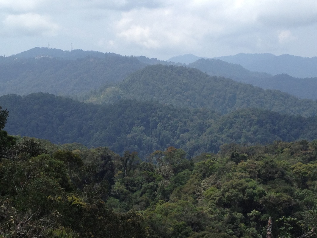
Beautiful view to the west from near the start of the trail. The three tall peaks in the background are the peaks of the Titiwangsa mountain range separating Selangor from Pahang. The middle peak is Gunung Semangkok, the tallest mountain in Selangor
"Pine Tree Hill" is a rather unusual name for a Malaysian mountain (and yes, at 1453m, it is indeed a mountain and not a hill). Our peaks normally have Malay or indigenous names or at least names of people (e.g. Maxwell Hill). Pine Tree though sounds like a place you will find in England, Australia, Canada or the US. I had a number of theories of how the name could have come about, but I realised during this trip that the simplest answer must be the correct one.
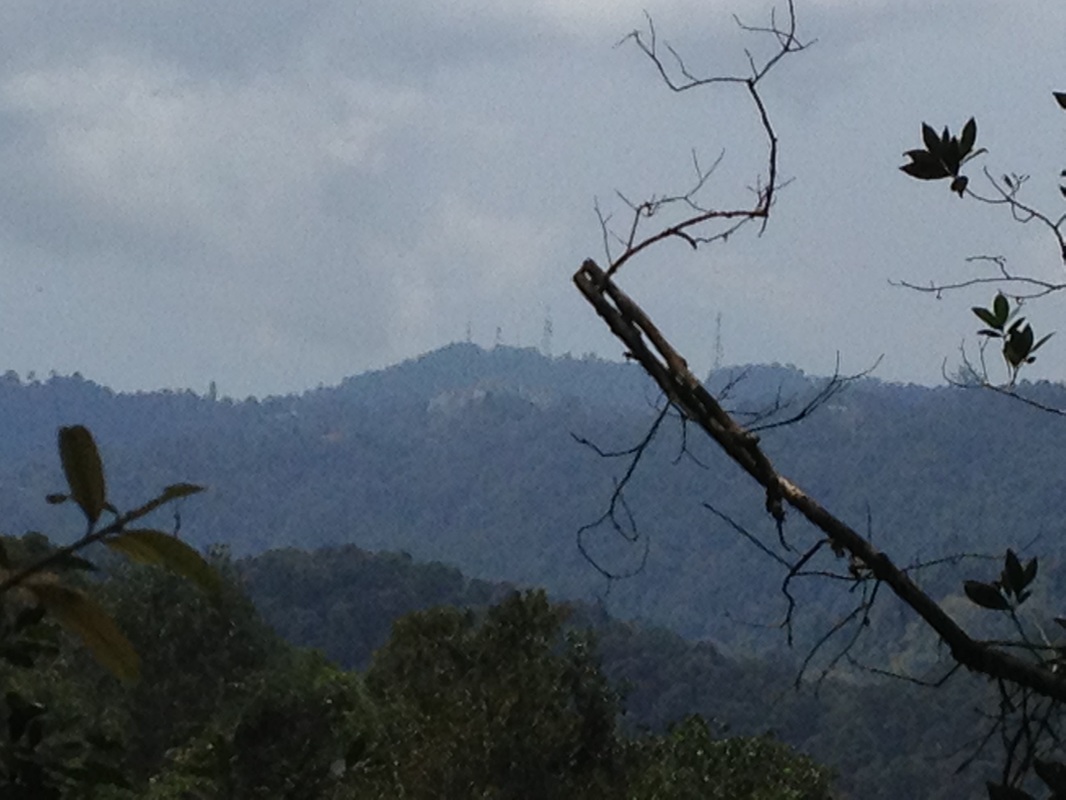
A view back to Fraser's Hill. The telecom towers of Bukit Peninjau can be clearly seen here
My earlier theory was that the mountain got its name from the road, High Pines Road. I conjectured that the English must have planted pine trees along that road, and the trail at the end of the road just took the name of the road "Pine Tree Trail". The peak at the end of the trail then was christened after the trail name. My primary reasoning for this was that pines (as far as I know, anyway) are not native to the peninsular. But it can grow quite easily in the cool, wet climes of the high mountains in Malaysia if they are brought in from elsewhere and planted, as is well in evidence in all our hill stations, including Fraser's Hill. So the pines must have been planted by the settlers at Fraser's Hill to give it a "temperate" atmosphere and in turn giving the road its name. Surely the English would not climb all the way to Pine Tree Hill and plant the pines there! What possible reason could they have for that!
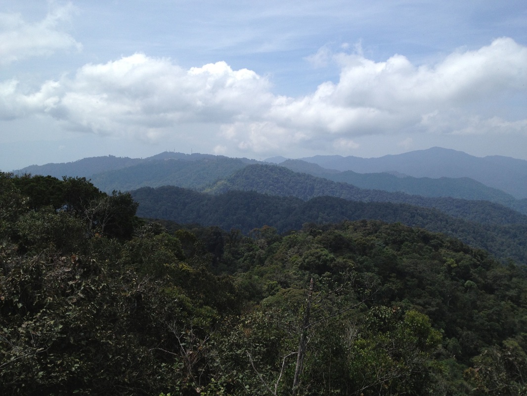
Fantastic view of Fraser's Hill from the peak of Pine Tree Hill. Fraser's Hill is in the middle of the picture, the 4 telecom towers can just about be seen against the sky. Between Fraser's Hill and Pine Tree (the tress in the foreground) are the two peaks that we had to traverse. On the right, at the background is the peak of Gunung Ulu Semangkok. It's peak is almost the same height as Pine Tree Hill.
But upon reaching the peak, it was obvious where it got its name - from the conifer trees that cover the very top of the mountain. The very tree that anchors the ropes that is used to climb to the peak is a conifer tree. I am not a botanist, but I believe these are not true pines, but a related family called southern conifers. The ground at the peak is littered with conifer leaves that resemble dog tails. The trail itself was probably created to facilitate boundary stone laying - the path straddles the boundary between Selangor and Pahang states connecting the peaks of the Titiwangsa mountain range. We saw many boundary stones along the way, including at the peak of Pine Tree Hill. So the boundary stone layerers named the peak after the trees, and the trail gets its name from the prominent mountain along the way. And of course High Pines Road got its name because it led to the Pine Tree Trail. I wouldn't be surprised if the whole road was itself part of the original Pine Tree Trail years ago.
A close-up of Fraser's Hill. The buildings and towers can be clearly seen
The trailhead is at the end of High Pines Road, just after the Telekom Malaysia guest house. You can't miss it for it has a large entrance gate with the words Pine Tree Trail written on top. Right near the beginning, there is great view to the west where the great mountains further along the trail can be seen. In fact, the trail, and especially the Pine Tree Hill summit offers fantastic vistas.
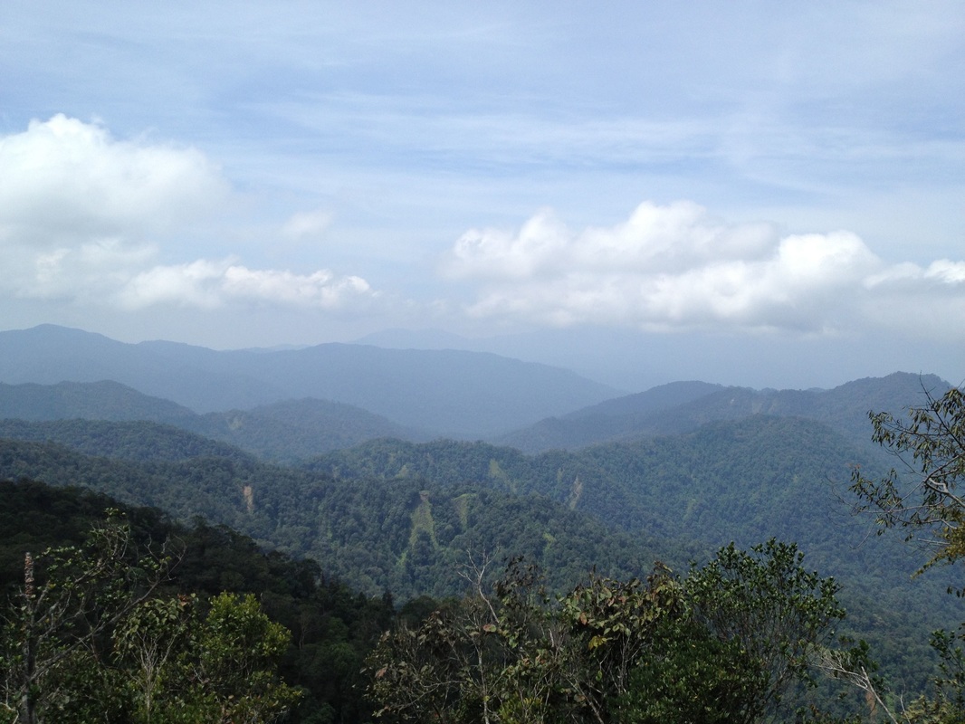
View to the west, faraway in the distance, just visible under the cloud is mighty Gunung Benum
The trail starts out flat and then slowly heads downwards through gentle leaf covered stepped path for about 1km. There are a number of fallen tree obstacles that must be traversed, but nothing difficult. We had by now descended about 100m from our starting altitude and reached the lowest point in the trail.
Close-up of Gunung Semangkok (the one in the back, middle peak)
Then the climb to the first peak begins. the ascent is quite steep and fairly long and ends at the "broken hut". This is the first of two peaks that we have to climb through before ascending Pine Tree Hill itself. This first peak is about 1340m in altitude, slightly higher than the starting point. From here the trail descends steeply through a million cement steps, switchbacks and slippery, muddy paths for 0.5km. Then the path climbs again to the 2nd peak. The 2nd peak is actually a longish mountain with 3 peaks in a row. We only pass through the 2nd of the 3 mini-peaks and weave through the other two. The highest point that we reach on this mountain is about 1300m.
Looking to the south in the direction of Kuala Kubu Bahru
We descend once more, and at the lowest point come to a place marked "Water Point". On the left of the trail, there is a path that leads to a small stream. Just a few metres ahead, on the right, is a bare knoll which looks like a camping ground. From here, the path ascends to Pine Tree Hill. It's about 2km to the peak from the camping area. There are laminated paper markers along the way that indicate how far we have ventured from the trailhead. Oddly, the distances are unusual numbers like 4.2 km, and then 4.5 km. I imagine the trails must have originally been marked every quarter mile or in chains or some silly measure of yore which was simply converted to the nearest km. In any case, my GPS tells me that the markings are wrong. Total distance to the peak is not 5km as stated in the trail markings, but about 6.8km.
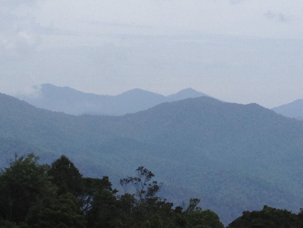
View to the southeast
Just before the peak, we come to a vertical cliff of some 10 or 15m in height. There are ropes installed to assist the climb but one can also use the many tree roots and rock footings as leverage to climb. When we reached the top, we were greeted with a strange scenery of mossy ground and crooked conifer trees. Venturing a few further metres, the path divides into three: the left path, which goes up a little over slippery rocks takes us to a small grass clearing with a marker stone in the middle. This I understand is the actual peak of Pine Tree Hill. There is a breathtaking view from here looking east back to Fraser's Hills. Fraser's Hill is easily recognisable with the 4 telecom towers peeking above the trees. We can see clearly the 2 peaks between Fraser's hill and us which we had to travel through. Further behind Fraser's Hill, Gunung Gap and Gunung Ulu Semangkok are plainly visible. Beyond the grassy clearing, there appears to be a path leading down the hill on the other side. But it's not a trail and it leads nowhere.
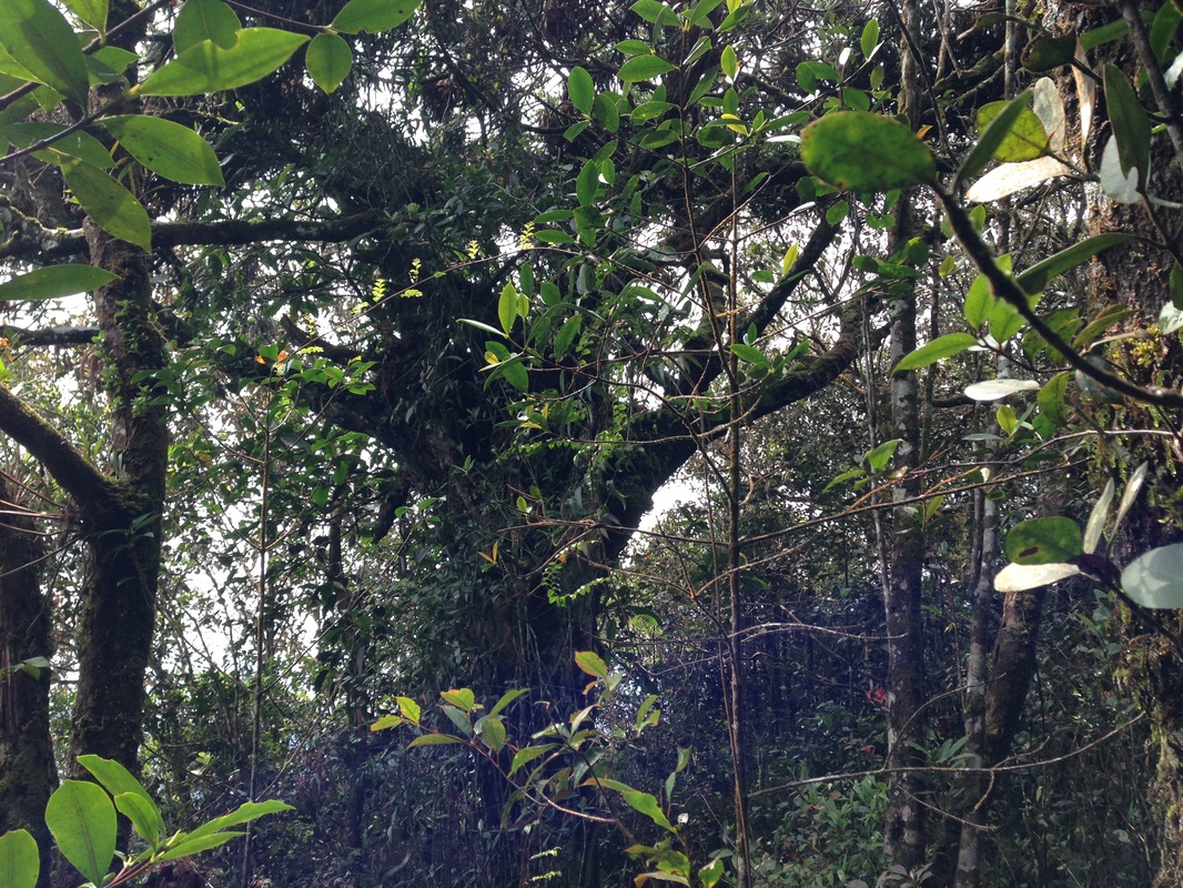
A conifer tree at the Pine Tree hill. The place probably got its name from these trees
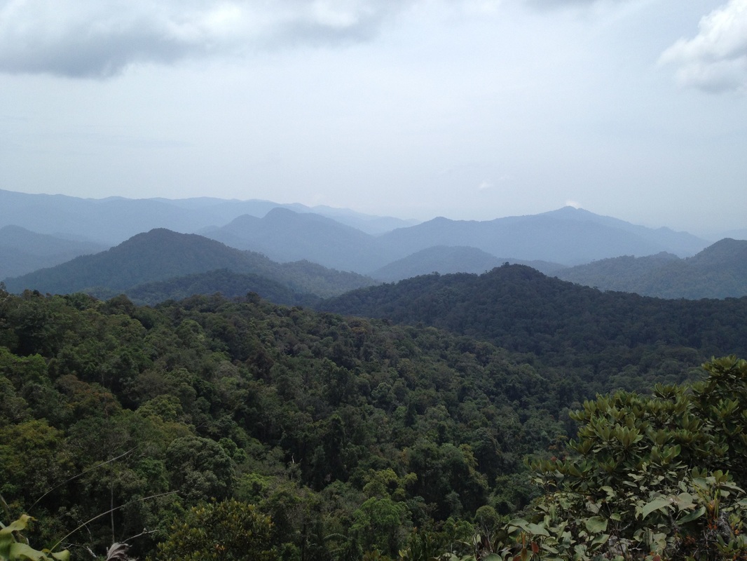
Back at the cross-roads, the path to the right leads through the trees onto a kind of a floating ledge made out of tree roots. From here is a magnificent view of the mountains further along the way: Rhodo Hilll (a.k.a Twin Peak) and the peaks leading to Gunung Semankok, the highest peak in Selangor. From here, on a clear day, Gunung Benum deep inside Pahang is also visible.
The middle path leads down a narrow corridor between trees and stone sides and comes very soon to a tiny valley of sort with muddy, water-logged ground. There is a path to the right, which is barred using a twig, and a path to the left. The left path leads apparently to Rhodo Hiill or Twin Peak. Our original intent on this trip was to attempt Twin Peak. But nobody else wanted to try so we turned back.
Despite the less than ideal conditions, I was impressed to see that everyone made it past the first 2 peaks. 2 turned back after that while another two turned back at the "4.5km" mark just short of the rope climbing cliff. The remaining 6 of us made it to the top of Pine Tree Hill. Not bad.
The journey back was just a re-trace of our onward route. We moved fairly fast and got back to the trailhead in record time (for us). The trek is about 3.5 hours each way.
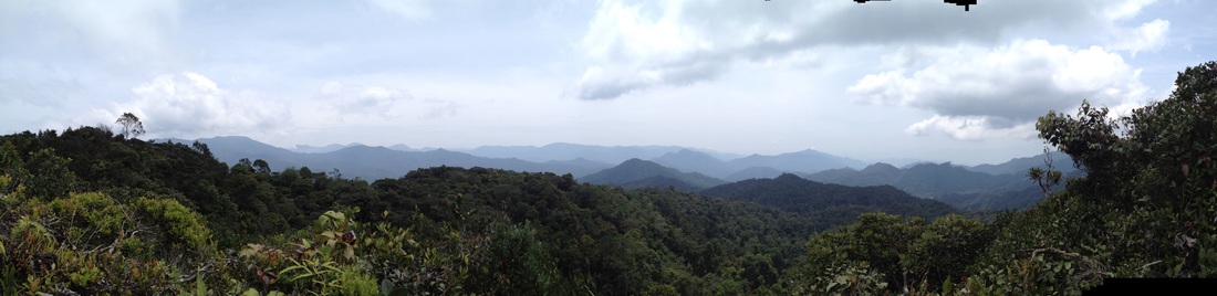
Panorama looking to the north, with Semangkok in the middle The peak on the extreme left, foreground, with the large fan-like tree is Rhodo Hill, a.k.a. Twin Peak
Because there are several peaks that must be summited before reaching Pine Tree Hill, the journey back is as tiring as the journey there. Ensure you have enough energy reserves to make it back
Trail Map and Data
| Location: | Fraser's Hill |
| Distance: | 7.0 km (one way) |
| Duration: | 4:04 hrs |
| Average Speed: | 1.7 km/h |
| Min Elevation: | 1215 m |
| Max Elevation: | 1437 m |
| Vertical Up: | 460 m |
| Vertical Down: | 460 m |
Related Posts
- Gunning Gap and Ulu Semangkok

