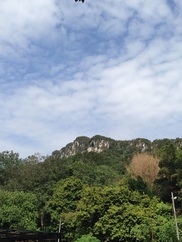
 Bukit Tabur West with it's quartz spine reaching above the forest
Malaysia, Kuala Lumpur, Taman Melawati
250m | 4.0 km | 3 hours
I first heard about Bukit Tabur in 1994 from my boss, who climbed the hill as a scout during his school days (presumably in the 70s). Until then, I had never heard of this place, but I wasn't from Kuala Lumpur, so maybe that's why. Anyhow, I filed the name away and did not think about it until now. We were looking for places for our Sunday Trekking Gang to hike on short getaways and I remembered the name from years ago. Some research and reconnaissance led to many wonderful discoveries and my boss was right, it is an incredible place well deserving of our repeated visits there!
There is Tabur West, the more popular trek, and Tabur East (and Tabur Far East and Tabur Extreme even further east). After having trekked Tabur West a number of times, we wanted to see how far we could go westwards and whether we could reach the part of the ridge that overlooks the Karak Highway.
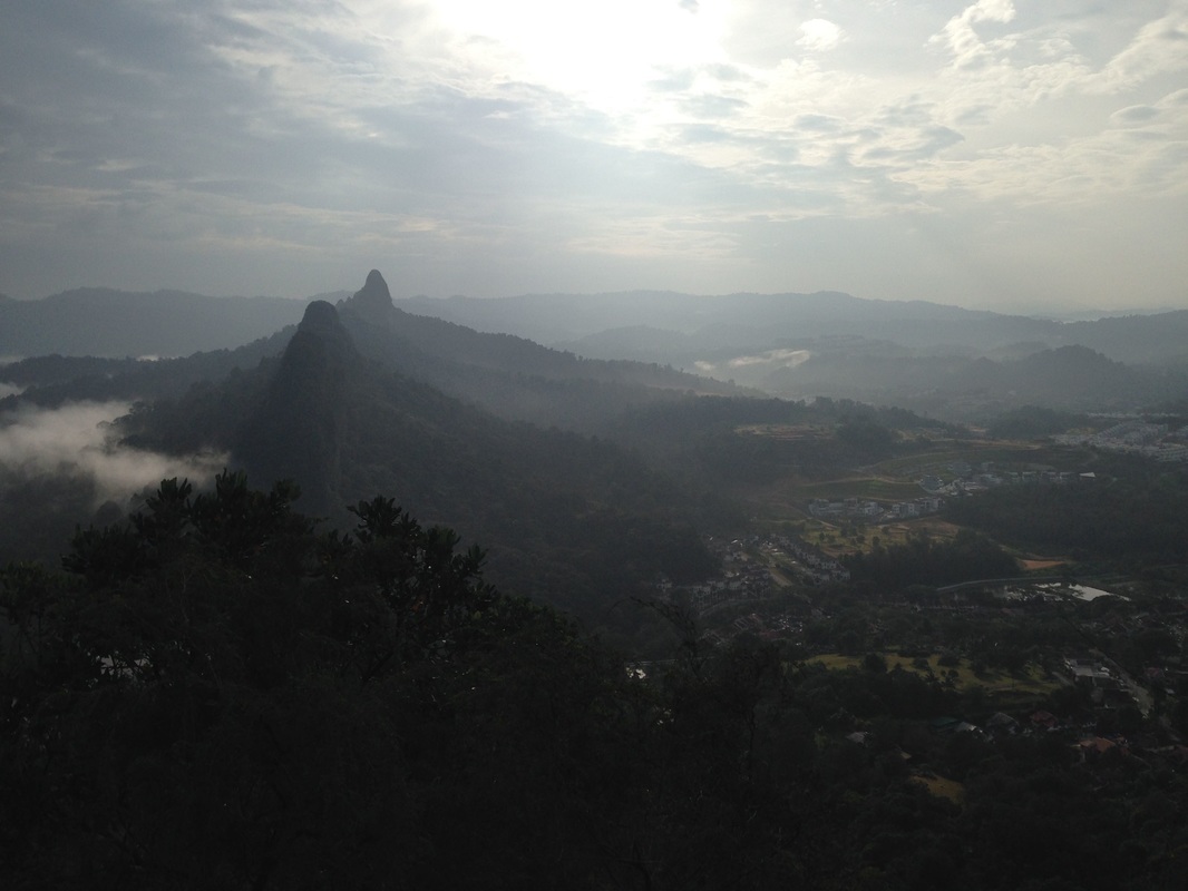
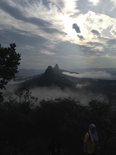 The peaks of Bukit Tabur East and Tabur Extreme in silhouette surrounded by morning mist with the sun shining down. Like a scene from King Kong - the beast lives in between the two peaks
The starting point for Tabur West is at the end of Jalan Kolam Air, a few metres before reaching the Klang Gates Dam entrance. On the hills on the left, there is a trail that rapidly heads up into the hill.
The initial part of the trek is through normal jungle. But the trees quickly make way for a rocky terrain with short shrubs and moss. We made our way to the first peak as quickly as we can as we wanted to get to the tricky rock climbing portions before the throng of crowds reach there. Tabur West is very popular, no doubt due to the amazing views that it affords, and on weekends can attract hundreds of trekkers. And this can cause a long tailback on stretches of the hike which require single file climbing or the use of ropes.
We cleared the first few peaks without fuss and reached the difficult vertical climb between peaks 9 and 10. It took us a couple of minutes to clear that hurdle. We then reached the next difficult part, the vertical drop just after peak 10. Because of the lack of toeholds it's a difficult stretch to get pass, and we struggled for some while before making it through.
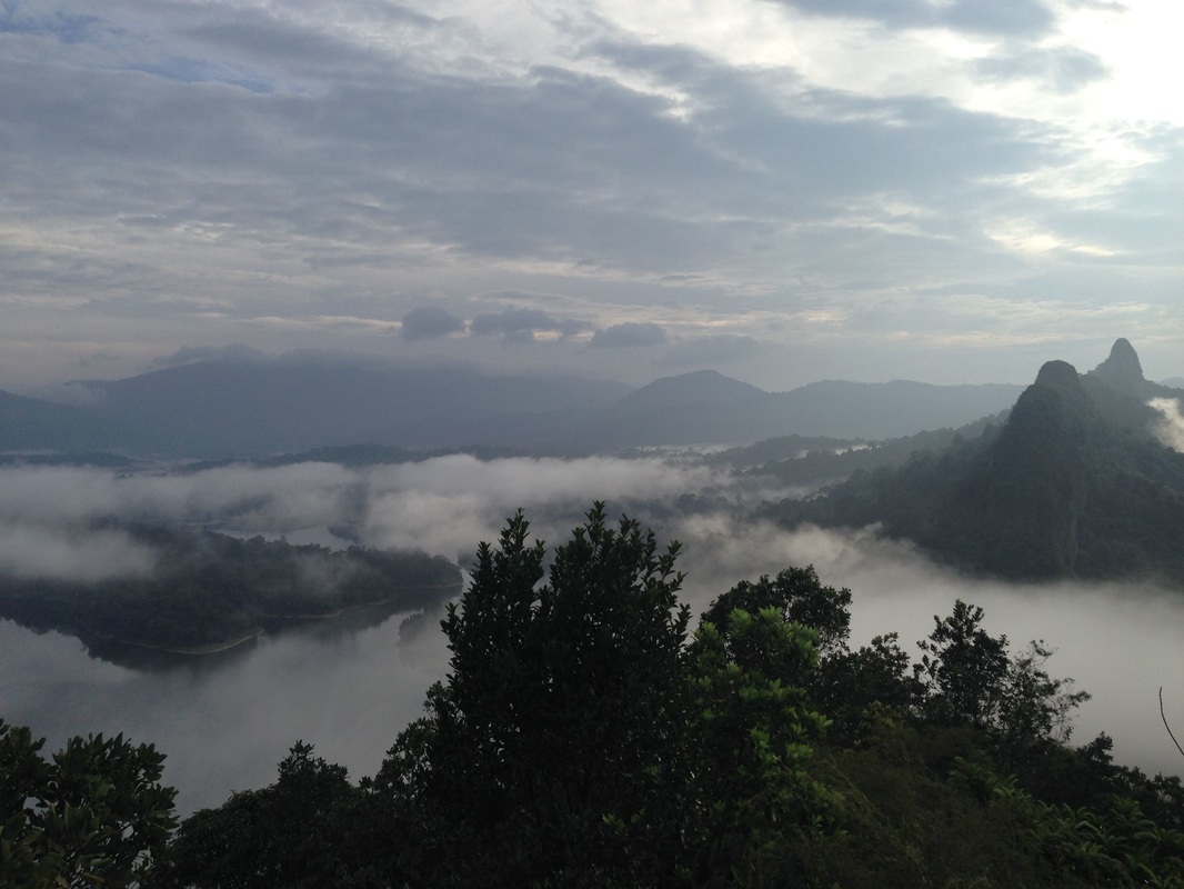
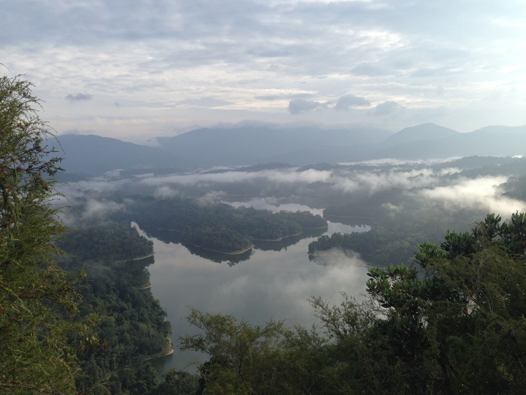
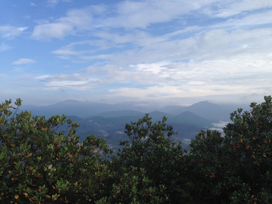
View of East from Peak #5. The peaks of Tabur East are in silhouette, with the the right most being Tabur Extreme and the two on the left being Tabur East peak #1 and #4. In the background on the right side of the picture, there is a mountain streching from the right edge of the picture to about the middle. The high, massif-like peak in the middle is Gunung Chenuang. Behind Chenuang is an even higher range of mountains, the Titiwangsa range, which is shrouded in clouds. Nuang is exactly behind Chenuang but cannot be seen due to the cloud cover. Klang Gates Reservoir is seen here covered in early morning mist
From then on, it wasn't long before we reached the highest peak at 391m. We descended down to where the return path through the jungle starts, and where most people turn left to head home. We wanted however to continue straight to the next peak. The climb up was quite easy. My GPS told me that this peak was 391m, the same as the one before. Some say that this is the highest peak on Tabur West, but I am not so sure. The path started descending slowly, and then more rapidly. After about 0.2km from the exit junction, we reached the end of the path - what lay ahead was a steep vertical drop to the jungle below, and then another vertical cliff about 50m ahead of us. The next peak looked lower than the last one we were on, but it was nevertheless still a high peak. We didn't see anyone on the next cliff, but there were signs I thought of some paths on that cliff. It's possible that there is another way to that peak from some other point on the jungle floor.
We turned back to the exit point and left through the jungle path back to Jalan Kolam Air. Did we reach the Karak Highway? Kind off - from the last peak, the highway was clearly visible and very audible too! But it wasn't the peak that was closest to the highway, there were many more peaks, albeit lower ones, before the Karak Highway pass.
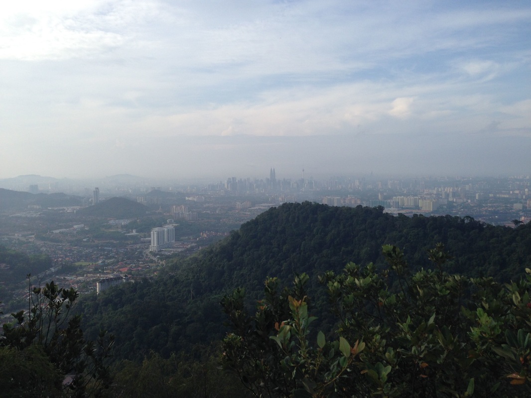
View of Kuala Lumpur with the twin towers in the middle. The hill in the middle is part of Bukit Tabur where there is a fat protrusion towards the city. While the quartz ridge portion of Bukit Tabur is in Selangor, the protrusion is inside the Federal Territory of Kuala Lumpur. I understand that the protrusion (about 310m high) is technically the highest point in the Federal Territory, and not Bukit Setiawangsa (about 295m)
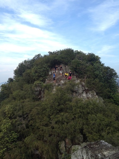 Climbers on the higher Peak #11 looking down on those struggling to climb down a challenging 3m vertical drop from Peak #10
Bukit Tabur can be a dangerous place due to the steep sides and one has to observe great caution. The place gets busy after about 11am, best to avoid these times. Keep your distance from others lest they accidentally push or shove you and make you lose balance. And be careful when posing or taking pictures. I have seen people blocking others and creating a huge tailback because they want to pose for pictures. I saw a guy almost fall to his death because he wanted to smile for a picture with double V-sign with his hands - while standing on a vertical ledge with just his toes. He was slowly falling behind without realizing. He was almost off the ledge when we starting shouting at him to hold on!! It takes only a second...
From some peaks, there are several paths to the next one - don't be lazy, if you have to climb down and ascend again, do so. Some attempt to edge across on ledges or even jump across. If you are not a mountain goat, don't be a fool. Always look for the safest way across and do not continue if you are not comfortable. Don't let peer pressure force you beyond your comfort zone. Despite the short distance and modest heights of the hill, it is NOT A WALK IN THE PARK.
From some peaks, there are several paths to the next one - don't be lazy, if you have to climb down and ascend again, do so. Some attempt to edge across on ledges or even jump across. If you are not a mountain goat, don't be a fool. Always look for the safest way across and do not continue if you are not comfortable. Don't let peer pressure force you beyond your comfort zone. Despite the short distance and modest heights of the hill, it is NOT A WALK IN THE PARK.
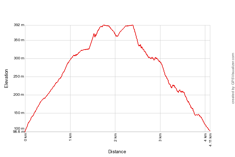
Trail Map and Data
| Location: | Taman Melawati |
| Distance: | 4.1 km |
| Duration: | 3 hrs |
| Average Speed: | 1.3 km/h |
| Min Elevation: | 100 m |
| Max Elevation: | 392 m |
| Vertical Up: | 330 m |
| Vertical Down: | 330 m |
